Lyle Cherry Orchard Hike
Lyle Cherry Orchard Trail in Washington
The Lyle Cherry Orchard Trailhead is a hiking area and tourist
attraction located on Lewis and Clark Highway in Lyle, Washington. The trail is
a variable-distance, mostly out-and-back hike that's 6.5 miles if we include
the Cherry and Lyle loops. We can hike the Cherry Orchard Loop for a 5-mile
roundtrip outing, or the slightly shorter Lyle Loop at 4 miles roundtrip.
Ø Start
Point: Lyle Cherry Orchard Trailhead
Ø End
point: Lyle Cherry Orchard
Ø Distance:
6.5 miles
Ø Elevation
gain: 1340 feet
Ø Difficulty:
Moderate
Ø Significance: Washington Wildflower hikes
This hike is very beautiful, with lots of flora and fauna to admire in wildflower season. The trail also offers amazing views of the Columbia River Gorge from Washington side. This is a very popular area for Wildflowers watching, birding, hiking, and running.
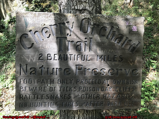
Warning: There is abundant poison oak along the edges of this trail.
Beware of Poison Oaks , Ticks and Rattle snakes.
Trail Head Directions: Lyle Cherry Orchard Trailhead on Lewis and Clark Highway (Washington SR 14) in Lyle, WA 98635, 1 mile east of Lyle, after the tunnel.


Post a Comment