Aug 20, 2020

Rowena Crest Viewpoint Oregon

Rowena Crest Overlook near Portland

The Rowena Crest Viewpoint is a spectacular overlook on the Historic Columbia River Highway in Oregon, known for its breathtaking views of the Columbia River Gorge. 

Rowena Crest Viewpoint

Rowena Crest overlook
Rowena Crest viewpoint Trails

This Iconic viewpoint offers incredible view of the winding horseshoe curves of the highway below, with the Columbia River and the cliffs of the gorge forming a dramatic backdrop. The Rowena Crest viewpoint is part of the Tom McCall Preserve, a nature reserve with hiking trails. The McCall PointTrail is a popular option that leads to even more panoramic views of Mt hood and Mt Adams. 

Best time of year to go: During spring (typically late April to early May), the hillsides are covered with colorful wildflowers, including balsamroot and lupine, making it an especially popular time to enjoy the bluff views with wildflowers. 

Rowena Crest Viewpoint Oregon
Rowena Crest overlook Oregon
Columbia River Highway Overlook
Columbia River Highway in Oregon

How to Reach:

Location: Rowena Crest Viewpoint is located between Hood River and The Dalles, Oregon.

Driving: From Portland, it's about a 1.5-hour drive east on I-84. Take exit 69 for Rowena Crest and follow the road uphill to the parking area.

Aug 15, 2020

Tom McCall Point Trail

 McCall Point Trail Near Portland

McCall Point Trail, also known as Tom McCall Point Trail, is a scenic hike located in the Columbia River Gorge near Mosier, Oregon. It’s part of the Tom McCall Preserve at Rowena, managed by The Nature Conservancy to protect sensitive wildlife and habitats.

Tom McCall Point Trail

Best hike to view Wildflowers Oregon
Best hike to view Wildflowers
Columbia River Gorge - Wildflowers View

🌼 Trail Highlights

  • Distance: Around 4.5 Miles
  • Elevation Gain: Around 1000 Ft
  • Difficulty: Moderate
  • Route Type: Out-and-back
  • Trailhead: Rowena Crest Viewpoint (parking is free)
  • Season: Open March 1 – October 31 (closed in wet season to prevent erosion)
  • Features:
    • Stunning views of the Columbia River Gorge, Clear day we can see the Mt hood.
    • Spring wildflowers like balsamroot and penstemon
    • Wildlife sightings (watch for ticks, rattlesnakes, and poison oak)


McCall Point Trail Near Portland
McCall Point Trail Hike
Columbia River Gorge Oregon

Best hike to view Wildflowers: The hike is especially famous for its phenomenal display of wildflowers in the spring, typically peaking from late April to early May. Expect to see vibrant balsamroot, lupine, and other colorful blooms.

McCall Point Trail Oregon
Mt hood View from McCall Point

How To Reach: The trailhead for the McCall Point Trail is at the Rowena Crest Viewpoint on the Historic Columbia River Highway, a popular scenic overlook near Mosier, Oregon.


Aug 11, 2020

Portland Rose Garden

Portland International Rose Test Garden

 The International Rose Test Garden is a rose garden in Washington Park in Portland, Oregon, United States. There are over 10,000 rose bushes of approximately 650 varieties. The roses bloom from April through October with the peak coming in June, depending on the weather. Due to this garden Portland's got the nickname as, "City of Roses" .

The garden is terraced into the hillside, on clear days it providing scenic views of downtown Portland, views of Portland’s skyline and Mount Hood.

Oregon Rose Garden
 
Portland Rose Garden

Portland Oregon Rose Garden

Portland International Rose Test Garden

International Rose Test Garden Fun Facts :

It is founded in 1917, this is the oldest public rose test garden in the United States and features over 10,000 rose bushes.

Address : 400 SW Kingston Ave, Portland, OR 97205.

Area : It covers around 4.5 Acres.

Hours: 5 a.m. to 10 p.m. daily.

Admission is Free to visit.

Best time to visit: The garden is most beautiful when the roses are in full bloom, typically around May - June.


Washington Park International Rose Test Garden

Portlands skyline View

International Rose Test Garden

Other closet attractions to visit nearby:

·         The Portland Japanese Garden

·         Oregon Zoo

·         World Forestry Center

·         Peninsula Park


Aug 6, 2020

Siouxon Creek Hike Washington

 Siouxon Creek Hike in Gifford Pinchot National Forest

The Siouxon Creek Trail is a moderate-to-difficult hike in the Gifford Pinchot National Forest, known for its lush forests and waterfalls. Hikers should be aware of conditions left by recent wildfires and be prepared for unbridged creek crossings.

There are several hikes in the Siouxon Creek Trail, offering different experiences and difficulty levels. 

Siouxon Creek Trailhead
Siouxon Creek Trail 130
Gifford Pinchot National Forest Wa

Trail #130 Siouxon : This 12-mile trail runs along and crosses on rustic log bridges or fords many creeks. It offers views of spectacular waterfalls including Horseshoe Falls. The trail connects with Huffman Peak Trail #129, Horseshoe Ridge Trail # 140, Chinook Creek Trail #130A and Wildcat Trail # 156.

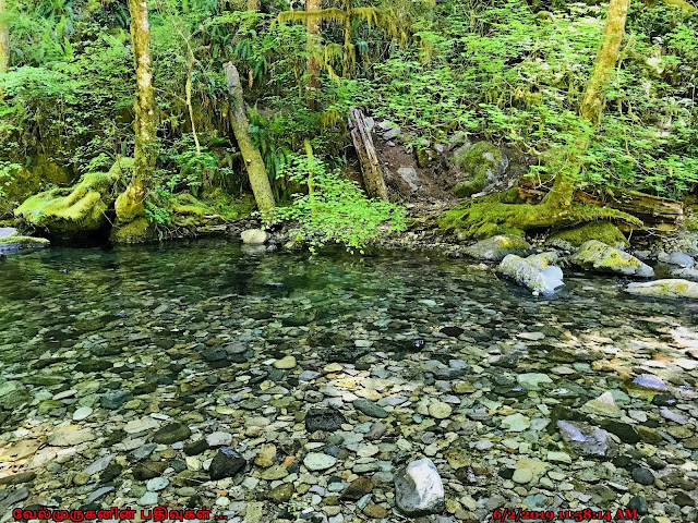
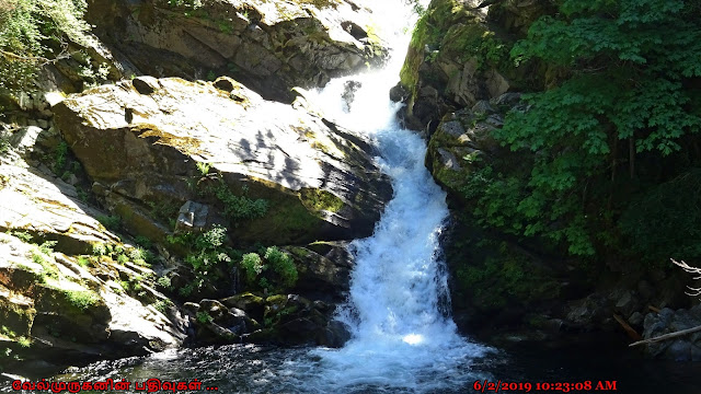
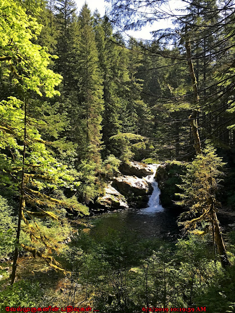
In the Siouxon Trail offers many waterfalls, clear water creeks, and colorful pools.

Siouxon Falls

Chinook Falls

Horseshoe Falls

Wildcat Falls


Siouxon Creek Trail Wildflowers
Siouxon Creek Trail Waterfalls
Siouxon Creek Trail WA
Siouxon Creek Pools

Directions to Siouxon Creek Trail:  Take SR 503 to the town of Chelatchie and turn east onto NE Healy Road. Follow this road, which becomes FSR 54 after a couple miles, for 9 miles and bear left (uphill) on FSR 57 (54 turns to gravel at this point while 57 remains paved). Just over one mile further turn left onto FSR 5701 (still paved) and follow it to its end 3 3/4 miles further at the Siouxon Creek Trailhead

Aug 2, 2020

Wildcat Falls Washington

 Wildcat Falls Gifford Pinchot National Forest

Wildcat Falls is a waterfall in Washington that drops over 200 feet in three tiers. It is the highest waterfall in the Siouxon drainage. The trail to Wildcat Falls passes by two other waterfalls, Lower Wildcat Falls and a 25-foot slide falls. The trail is located in Gifford Pinchot National Forest and is about 12 mile long. The area was also partially burned by the 2020 Big Hollow Fire. 

Wildcat Falls Gifford Pinchot National Forest
Washington Wildcat Falls
Siouxon drainage

Hike description: The Wildcat Trail (Trail #156) is a steep incline that climbs a ridge from the Siouxon Creek valley. The full loop trail that includes Wildcat Falls is a strenuous, approximately 12-mile hike with significant elevation gain.

The Wildcat Falls area can be combined with a longer hike that includes other notable waterfalls on the Siouxon Creek trail system, such as Siouxon Falls and Chinook Falls. This popular backpacking route is known for its moss-covered forests, clear water, and colorful pools.


Wildcat Falls Washington
Wildcat Falls Trail
Siouxon Creek valley
Hike in Gifford Pinchot National Forest

Other Major waterfalls on the Siouxon Trail loop

Siouxon Falls

Chinook Falls

Horseshoe Falls

How to Reach: To reach Wildcat Falls in Washington, we must drive to the Siouxon Trailhead in Gifford Pinchot National Forest, east of Chelatchie, and then hike few miles in the Siouxon Trail loop.

Location: Gifford Pinchot National Forest, accessed via Forest Service Road 5071 near the town of Chelatchie.

Jul 21, 2020

Chinook Falls Washington

 Chinook Falls in Gifford Pinchot National Forest

Chinook Falls is 60-foot waterfall, most spectacular when water levels are high, pours wide Chinook Creek over a rock ledge. The waterfall is best viewed from mid-creek or the west side of the creek. Currently, a large log chained to the bank serves as a "bridge." The log can be slippery when wet, but in the dry summer months it is an easy walk across. Chinook Creek has a crystal-clear water and colorful pools. 

Chinook Falls Washington
Chinook Falls WA
Chinook Creek in Gifford Pinchot NF
Gifford Pinchot National Forest Washington
Water Falls in Gifford Pinchot NF

Chinook Falls is often the destination of choice for day hikers along the Siouxon Creek trail. It can be accessed via Chinook Creek Trail #130A in Gifford Pinchot National Forest.


Chinook Falls in Gifford Pinchot NF
Chinook Creek Trail Clear Pools
Chinook Creek Trail #130A

Directions to Chinook Falls:

Take SR 503 to the town of Chelatchie and turn east onto NE Healy Road. Follow this road, which becomes FSR 54 after a couple miles, for 9 miles and bear left (uphill) on FSR 57 (54 turns to gravel at this point while 57 remains paved). Just over one mile further turn left onto FSR 5701 (still paved) and follow it to its end 3 3/4 miles further at the Siouxon Creek Trailhead. Hike the Siouxon Creek Trail for four miles to a junction and head left across the footbridge onto Chinook Trail #130A and follow it for another 1/4 of a mile to the bottom of the falls.

Jul 16, 2020

Siouxon Creek Falls Washington

 Siouxon Falls - Gifford Pinchot National Forest

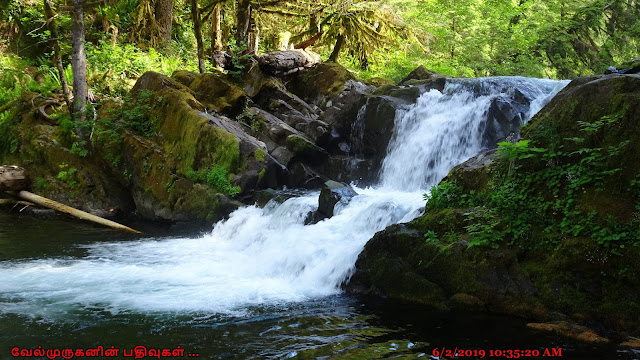
Siouxon Falls is the first of many waterfalls hikers encounter along the length of Siouxon Creek trail while following its namesake trail. The falls - the second largest along the length of creek paralleling the trail - flumes 28 feet down a narrow crack in the bedrock then spills into a huge blue pool popular for swimming and fishing alike. The falls are a common turn around point for hikers looking for an easy stroll, but better waterfalls further up the drainage beg for additional exploration. A small 9 foot fall can be found along the creek a third of a mile further upstream. 

Gifford Pinchot National Forest - Siouxon Falls
Siouxon Creek Falls Hike
Siouxon Creek Falls Trail Washington

Upper Siouxon Falls

Siouxon Creek is a stream well-endowed with waterfalls - eight drops of 5 feet or more are known to exist along its length, but only half of those are significant enough to warrant inclusion in this database. The uppermost fall along the creek is a 16 foot tall plunging block-type waterfall that stretches to over 30 feet in width during periods of high flow. The creek drops over such a uniform ledge and into such a perfect pool that one could be excused for assuming the falls were not natural. 

Upper Siouxon Falls WA
Siouxon Creek Falls Washington
Washington Siouxon Falls

Directions to Siouxon Creek Falls:  

Take SR 503 to the town of Chelatchie and turn east onto NE Healy Road. Follow this road, which becomes FSR 54 after a couple miles, for 9 miles and bear left (uphill) on FSR 57 (54 turns to gravel at this point while 57 remains paved). Just over one mile further turn left onto FSR 5701 (still paved) and follow it to its end 3 3/4 miles further at the Siouxon Creek Trailhead. Hike the Siouxon Creek Trail for 1.8 miles to trailside vantages and a bench overlooking the falls.