Jun 26, 2020

Horsethief Butte Hike Washington

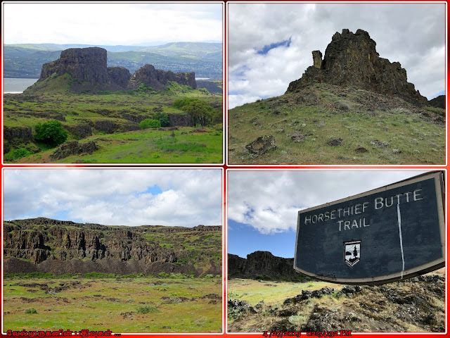
 Horsethief Butte in Columbia Hills State Park

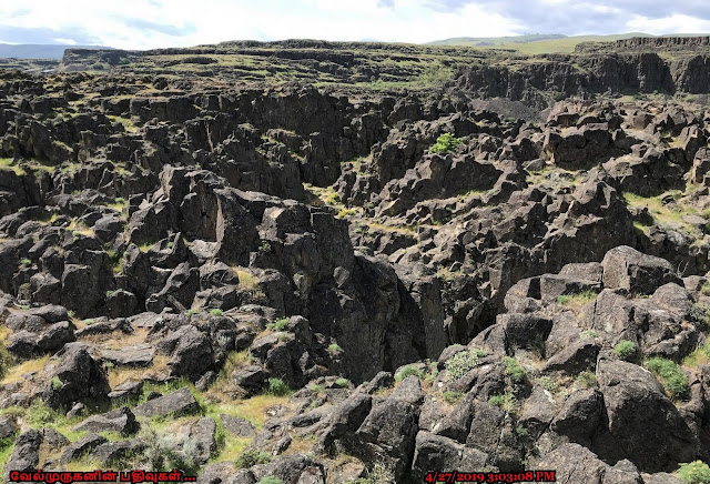
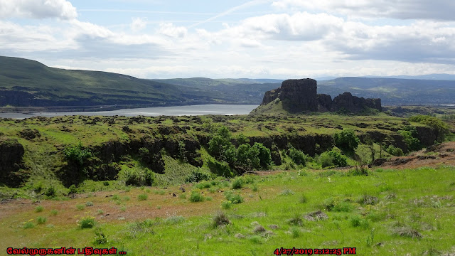
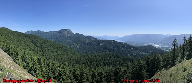
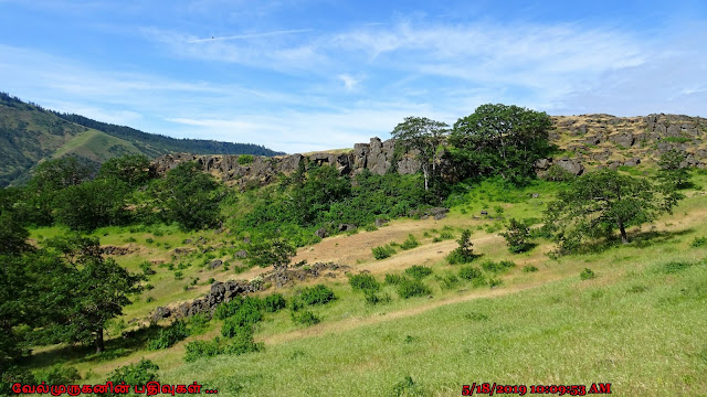
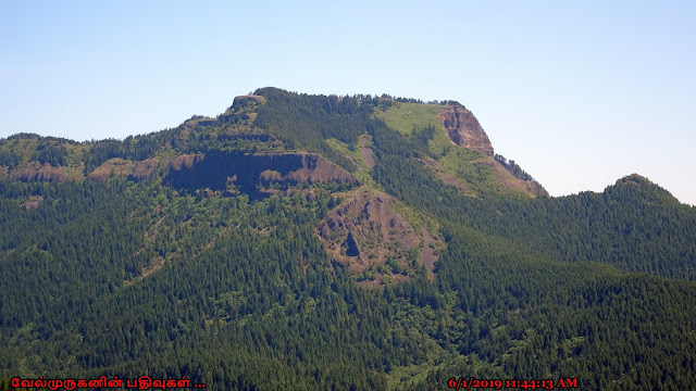
Horse thief Butte Trail is a 2-mile hike in Columbia Hills State Park, Washington. The trail is considered easy and dog-friendly. The trail offers views of the Columbia River and Mount Hood. The trail is marked and leads to the summit of the butte. The butte is made of hexagonal columns of Wanapum basalt flows that are about 15 million years old. The trail is located near Dallesport, Washington.

Horse thief Butte Washington
Horsethief Butte Columbia River
Horsethief Butte Hike

The Wanapum Basalt is one of the four major categories of lava flows in the Columbia River Basalt Group (CRBG).
Wanapum basalt flows Horsethief Butte

The trail is 2 miles roundtrip and has an elevation gain of 200 feet. The highest point on the trail is 498 feet.

Ø  Start point: Horsethief Butte Trail head

Ø  End point: Horsethief Butte Summit

Ø  Distance: Around 2 miles round trip

Ø  Elevation gain: 250 feet

Ø  High point: 498 feet

Ø  Difficulty: Easy

Ø  Fee to park in the trail head - Discover Pass

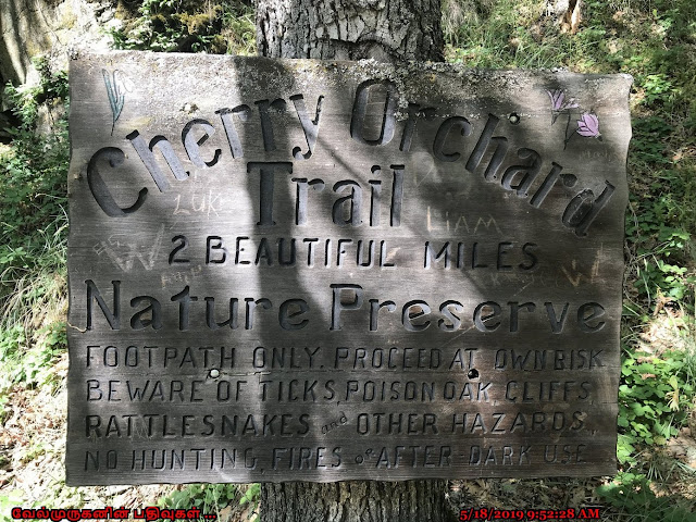
Ø  Beware of poison oak and rattlesnakes


Horse thief Butte Ice Age Floods
Horse thief Butte History
Columbia Hills State Park History

It is composed of hexagonal columns of Wanapum basalt flows that were scoured by the Ice Age floods some 10,000 years ago. This trail offers a short hike to sweeping views of the Columbia River and Mount Hood on the plateau around the base. Wildlflowers bloom around the base of Horsethief Butte in the spring, including grass widows, death camas and the pungent smell of Klickitat desert parsley.

How to Reach: From Vancouver, take SR 14 east through Lyle to the junction with US 197. (From The Dalles, take exit 87 off I-84 onto US 197 and cross the Columbia River, driving north 3.3 miles to the junction with SR 14.) Continue east on SR 14 for 2.8 miles to the signed trailhead parking area on the south side of the highway.

Horsethief Butte Summit WA
Horsethief Butte Trail WA
Horsethief Butte Trail

The trail is located on Washington State Highway 14, also known as the Lewis & Clark Highway. This scenic drive runs parallel to I-84 on the north side of the Columbia River.


Jun 21, 2020

Dalles Mountain Ranch Trail Washington

Dalles Mountain Ranch Loop Hike Washington

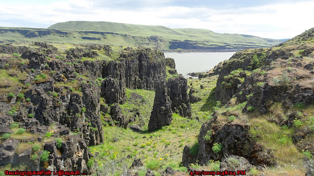
Dalles Mountain Ranch is a former 6,000-acre scenic cattle ranch in Washington state. It's part of the Columbia Hills State Park, which was created in 2003 when Horsethief Lake State Park and Dalles Mountain Ranch merged.
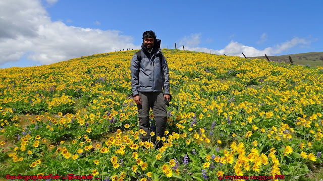
Balsamroot and lupine Dalles  Ranch
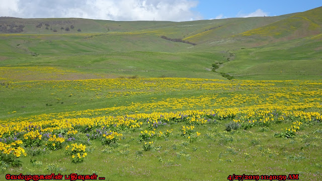
Balsamroot and lupine, Dalles Mountain Ranch
Browns Island Columbia River Gorge
Columbia Hills Natural Area Preserve

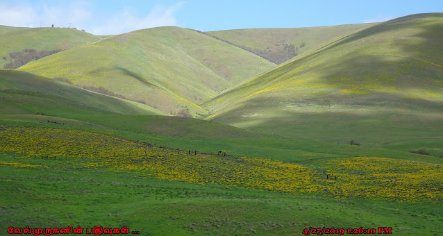
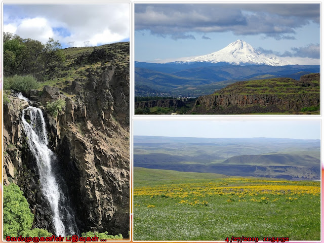
Dalles Mountain Ranch offers miles of hiking trails. The trails are well-maintained and made of dirt and grass. The trails are easy and have an elevation gain of 465 feet. The trails offer views of Mount Hood, wildflowers, and the Columbia River Gorge. The best time to visit this ranch is in the spring, especially in mid-April to May when the balsamroot and lupine is peak bloom. Every year (typically in April and may), the hillsides become engulfed in nothing but yellow and purple wildflowers. 

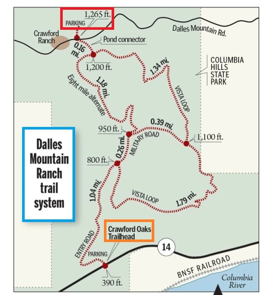
Ø  Start point: Crawford Oaks Trailhead

Ø  End point: Crawford Ranch

Ø  Hike Type: Loop

Ø  Distance: 7 miles

Ø  Elevation gain: 1060 feet

Ø  Difficulty: Moderate

Ø  Fee to park in the trail head - Discover Pass

Ø  Watch out for poison oak, ticks, and rattlesnakes


Dalles Mountain Ranch Car
Dalles Mountain Ranch Trail
Mt hood Dalles Mountain Ranch
Wildflowers Dalles Mountain Ranch


Dalles Mountain Ranch Car
It is one of Historical Landmark in Centerville, Washington, US

Old Abandoned Rusted car in springtime wildflowers, Dalles Mountain is one of most photographic spot in the trail. 

The Bleakney wagon Dalles Mountain
Dalles Mountain Ranch Trail Map
Dalles Mountain Ranch Hike

Directions to the Crawford Oaks trail head: From the intersection of U.S. 197 and SR 14, drive 3.6 miles east on SR 14 to the Crawford Oaks Trailhead and parking area, on the left (north) side of the road.

Other Trail head which is very close to Ranch Car - Dalles Mountain Ranch Trailhead

Drive I-84 east to Exit 87 for Dufur and Bend. After exiting, take a left for the DMV, DOT, State Police and The Dalles Dam.

Drive 3.6 miles, crossing The Dalles Bridge, to a right turn merge with Highway 14E for Kennewick.

From here, go 0.9 miles and make a left turn off Highway 14 onto The Dalles Mountain Road for the Columbia Hills State Park and Dalles Mountain Ranch.

Drive 3.4 miles on this gravel road and reach a junction at an old wagon and before a group of ranch buidlings.

Keep straight (right) here for 0.2 miles; then turn left up the hill and park in the Dalles Mountain Ranch Trailhead parking area.

Jun 16, 2020

Powell Butte Moonrise Hike

Powell Butte Moonrise Hike on the Meadow trail

Powell Butte hike is a combination of open meadow, forest paths, and gravel walkways. Powell Butte is a lesser-known gem within Portland and is the second largest park in the city.

Powell Butte Nature Park

Powell Butte Nature Park hike

Powell Butte Nature Park trail

Although this hike offers a good workout, we did this hike as a primary focus of hanging out at the summit and waiting for the moon to rise. The moon will rise at 7:58 but depending on exactly what position it is rising; first sighting of the moon can be delayed while waiting for it to rise over Mt. Hood. But unfortunately, its cloudy day we couldn’t able to see the Moon Rise.

Ø  Start Point: Powell Butte Dogwood Trailhead

Ø  Distance: 6-8 miles

Ø  Difficulty: Mostly moderate


The park is known for its diverse wildlife, including birds and small mammals. It's a great place for birdwatching. The hike can be enjoyed year-round, but spring and summer are popular times for wildflowers and clear views. 

Powell Butte Moonrise on the Meadow Hike

Powell Butte Moonrise Hike

Powell Butte Nature Park is situated in Southeast Portland, making it easily accessible for both locals and visitors.

Powell Butte Nature Park - Trail head

16160 SE Powell Blvd, Portland, OR 97236, United States 


Jun 10, 2020

Bothell Hindu Temple Washington

 Bothell Hindu Temple Washington

The Bothell Hindu Temple, officially known as the "Hindu Temple and Cultural Center (HTCC)," is a prominent place of worship and cultural activities for the Hindu community in the Bothell, Washington, area. The Hindu Temple and Cultural Center in Bothell serves as a place of worship, community gathering, and cultural education for the Hindu community in the Greater Seattle area. 

Bothell Hindu Temple Washington

Bothell Hindu Temple Lord Balaji

Bothell Hindu Temple Lord Shiva

Temple Main Mission is to

“Promote social, cultural, religious, and spiritual understanding based upon Vedic principles. “

“The cultural connection between your past and your future generations.”


Hindu Temple Bothell WashingtonBothell Jain Temple Washington
Bothell Hindu Temple WA
Bothell Hindu Temple Near Seattle

The HTCC effort was begun in the early 1980's to fulfill the need of the community for a place of worship, to celebrate festivals and other important occasions. The land purchase was completed in 1994 and the plans for Phase I were finalized by 1999. Got the construction permit in late 2001. In Feb of 2003, they installed the deities in the Phase I building's worship room.


Temple Hours

Weekdays: 9:00am - 12:00pm. 6:30pm - 8:30pm.

Weekends: 9:00am - 12.30pm. 5:30pm - 8:30pm.


Address:

3818 212th St SE,

Bothell, WA 98021,

United States

Jun 6, 2020

Hamilton Mountain Hike in Washington

Hamilton Mountain Trail in Washington

Hamilton Mountain is a popular hiking destination located in the Columbia River Gorge of Washington state. The trail offers stunning views of the Columbia River gorge, Mount Hood, and the surrounding area.

Hamilton Mountain Hike WAHamilton Mountain Trail WA
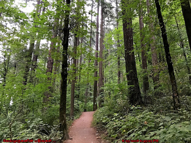
Hamilton Mountain Forest Washington
Hamilton Mountain Trail in Washington

The Hamilton Mountain hike is known for its varied terrain and rewarding vistas. The trailhead begins at the parking area in Beacon Rock State Park. Hikers ascend through forests and rocky sections, and during certain times of the year, wildflowers add to the beauty of the hike. One of the highlights is the Pool of the Winds, a small waterfall that cascades down a rocky chute. Further along, the trail leads to a series of viewpoints where hikers can see panoramic views of the Columbia River, Bonneville Dam, and the surrounding landscape. The final viewpoint at the summit of Hamilton Mountain provides a breathtaking vista of the Gorge.


Table Mountain Washington
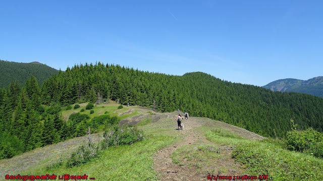
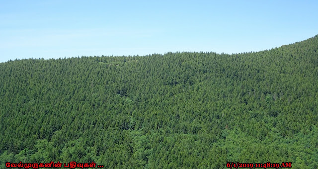
Pacific Northwest Forest View
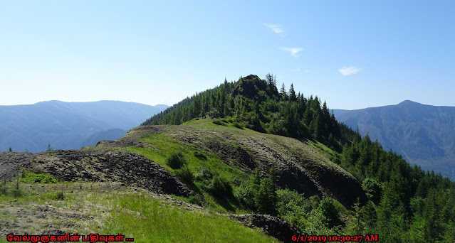
Mt Adams View from Hamilton Mt

Highlights of Hamilton Mountain Hike : 

Viewpoints: The trail features multiple viewpoints along the way, with the most popular being the summit viewpoint, which offers breathtaking panoramic views of the Columbia River Gorge, the Bonneville Dam, Beacon Rock, and, on a clear days, we can see the Mount Hood, Mount Adams, Mount Saint Helens and Table Mountain. 

Waterfalls: Rodney Falls and Hardy Falls is a smaller waterfall we will encounter on the trail, which is a nice bonus. 

Ø  Start point: Hamilton Mountain Trailhead

Ø  End point: Hamilton Mountain

Ø  Hike type: Lollipop loop

Ø  Distance: 7.5 miles

Ø  Elevation gain: 2100 feet

Ø  Difficulty: Moderate

Ø  Significance: Waterfalls, and Columbia River Gorge views


Wild Flowers in Hamilton Mountain
Hamilton Mountain Hike in Washington

Directions to the Trailhead:

The Hamilton Mountain Trail is typically accessed from Beacon Rock State Park.

Northwest Forest Pass for parking is required at the trailhead.

Jun 2, 2020

Lyle Cherry Orchard Hike

Lyle Cherry Orchard Trail in Washington

The Lyle Cherry Orchard Trailhead is a hiking area and tourist attraction located on Lewis and Clark Highway in Lyle, Washington. The trail is a variable-distance, mostly out-and-back hike that's 6.5 miles if we include the Cherry and Lyle loops. We can hike the Cherry Orchard Loop for a 5-mile roundtrip outing, or the slightly shorter Lyle Loop at 4 miles roundtrip.

Lyle Cherry Orchard Trail
Lyle Cherry Orchard Trailhead
Rowena Plateau Oregon
On a clear day we can enjoy the view of Rowena Plateau, McCall Point, Marsh Hill, Chatfield Hill, and Mount Defiance across the Rowena Gap. On the Washington side, we can see the Catherine Creek and Coyote Wall areas.

Ø  Start Point: Lyle Cherry Orchard Trailhead

Ø  End point: Lyle Cherry Orchard

Ø  Distance: 6.5 miles

Ø  Elevation gain: 1340 feet

Ø  Difficulty: Moderate

Ø  Significance: Washington Wildflower hikes


Cherry Orchard Trail Lyle WA
Columbia River Gorge View from Lyle
Columbia River Gorge WA
Lupinus in Lyle Cherry Orchard
Lyle Cherry Orchard Hike WA

This hike is very beautiful, with lots of flora and fauna to admire in wildflower season. The trail also offers amazing views of the Columbia River Gorge from Washington side. This is a very popular area for Wildflowers watching, birding, hiking, and running. 

Warning:  There is abundant poison oak along the edges of this trail. 

Beware of  Poison Oaks , Ticks and Rattle snakes. 

Lyle Cherry Orchard Trail Washington
Lyle Cherry Orchard Trail Hike

Trail Head Directions:  Lyle Cherry Orchard Trailhead on Lewis and Clark Highway (Washington SR 14) in Lyle, WA 98635, 1 mile east of Lyle, after the tunnel.