May 23, 2019

Seward Highway Alaska Scenic Route

Anchorage to Seward Alaska Scenic Highway Drive


The Seward Highway is a highway in the U.S. state of Alaska that extends 125 miles (201 km) from Seward to Anchorage. It was completed in 1951 and runs through the scenic Kenai Peninsula, Chugach National Forest, Turnagain Arm, and Kenai Mountains. 
Seward Highway Anchorage

The Seward Highway is numbered Alaska Route 9 (AK-9) for the first 37 miles (60 km) from Seward to the Sterling Highway and AK-1 for the remaining distance to Anchorage. At the junction with the Sterling Highway, AK-1 turns west towards Sterling and Homer.

About eight miles (13 km) of the Seward Highway leading into Anchorage is built to freeway standards. In Anchorage, the Seward Highway terminates at an intersection with 5th Avenue, which AK-1 is routed to, and which then leads to the Glenn Highway freeway.  
Alaska Scenic Byway Seward Highway
Alaska Seward Highway

Recognized for its scenic, natural, historical and recreational values, the 125-mile Seward Highway holds triple designation:
·         USDA Forest Service Scenic Byway,
·         Alaska Scenic Byway, and
·         All-American Road.

The first 50 miles of the Seward Highway skirts the base of the Chugach Mountains and the shore of Turnagain Arm, where it's common to see beluga whales, Dall sheep, waterfalls and eagles. The remainder of the drive courses through the mountains, offering dramatic views of wild Alaska. 

Anchorage to Seward (Seward Highway) 
The drive from Anchorage to the seaside community of Seward begins with two hours of spectacular views as you pass between the dramatic shorelines of Turnagain Arm and the jutting peaks of the Chugach Mountains. Your route continues through the Kenai Peninsula, famous for its array of outdoor activities. 
Seward Highway Alaska
Turnagain Arm Seward Highway Alaska
Seward Highway Chugach National Forest

The Kenai Mountains-Turnagain Arm National Heritage Area is a vibrant corridor of natural, cultural, and historic riches. This dynamic area runs from the “Gateway City” of Seward north to Indian, and spans Whittier’s Prince William Sound port on the east to Cooper Landing on the west. This means you can access several of these National Heritage Areas as you drive between Anchorage and Seward.


May 19, 2019

Upper Trail Lake Moose Pass Alaska

Upper Trail Lake Kenai Peninsula Moose Pass

Moose Pass is a scenic mountain village nestled on the southwest shore of upper Trail Lake on the Kenai Peninsula. Surrounded by the Chugach National Forest, it’s an ideal place for hikers and backpackers to stage outdoor adventures, and lies along both the Seward Highway and the Alaska Railroad, making it easy to reach from Anchorage, 100 miles to the north, or Seward, 26 miles to the south.  
Chugach National Forest
Kenai Peninsula Alaska Upper Trail Lake
Kenai Peninsula Upper Trail Lake

Moose Pass provides easy access to numerous Kenai Peninsula trails. The closest is Johnson Pass Trail, whose southern trailhead is at Mile 32.5 of the Seward Highway, just three miles northwest of town. This 23-mile trail winds over a 1,550-foot alpine pass, around two small alpine lakes and is part of the original Iditarod trail blazed by prospectors on their way from Seward to the golden beaches of Nome. Other trails only a short distance from Moose Pass are Carter Lake Trail, Victor Creek Trail, Ptarmigan Creek Trail and Lost Lake Trail.

Moose Pass Upper Trail Lake
Upper Trail Lake Alaska Moose Pass
Upper Trail Lake Alaska
Upper Trail Lake Kenai Peninsula

Upper Trail Lake is a lake located just 23.8 miles from Bear Creek, in Kenai Peninsula Borough, in the state of Alaska, United States, near Moose Pass, Alaska.

Directions to Upper Trail Lake : It is Located at mile 31.5 along the Seward Highway between the fish hatchery and the town of Moose Pass is a large gravel peninsula protruding out into Upper Trail Lake. The turnoff is easy to miss as it's located in the sharp corner on the highway. There is a turn lane going both directions to aid in traffic.

May 15, 2019

Resurrection Bay Alaska

Resurrection Bay - Kenai Fjords National Park

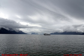
Resurrection Bay, also known as Blying Sound, and Harding Gateway in its outer reaches, is a fjord on the Kenai Peninsula of Alaska, United States. Its main settlement is Seward, located at the head of the bay. 
Kenai Fjords Wildlife Cruise Seward
Alaska Seward Resurrection Bay
Resurrection Bay Whale Watching

Resurrection Bay is the location of Caines Head, at the summit of which Fort McGilvray is situated, 650 feet (198 meters) above sea level. It is called the "gateway to the Kenai Fjords" as many water taxis, kayak tours, anglers, and recreational boaters use the bay to access nearby Kenai Fjords National Park. Several parks are located in and around the bay. Kenai Fjords National Park is primarily accessed by boat from Seward.

Several parks are located in and around the Resurrection Bay
·         Caines Head State Recreation Area
·         Lowell Point State Recreation Site
·         Sandspit Point State Marine Park
·         Sunny Cove State Marine Park
·         Thumb Cove State Marine Park
·         Fox Island

Best way to see explore the Resurrection Bay
·         Kenai Fjords and Resurrection Bay Half-Day Cruise
·         Kenai Fjords Wildlife Cruise
·         Kenai Fjords National Park Glacier and Wildlife Cruise

Resurrection Bay Cruise tours gives best option to explore 
Several alpine glaciers, nestled high in the Chugach and Kenai mountains surrounding Resurrection Bay, can be seen along the route if the weather cooperates. We will cruise by Bear Glacier, a piedmont glacier and the largest glacier in Kenai Fjords National Park.
Kenai Fjords National Park Cruise
Kenai Fjords National Park Glacier
Resurrection Bay - Kenai Fjords National Park
Resurrection Bay Alaska
Resurrection Bay Cruise tours Alaska
Resurrection Bay Cruise Tour Alaska
There is very good chance to see the six types of whales (fin, gray, humpback, minke and Orca whales) roaming the waters of Resurrection Bay.

As we approach the end of Resurrection Bay we will visit Cape Resurrection, home to both Steller sea lions and thousands of nesting seabirds including puffins, kittiwakes, and cormorants. The captain will stop the boat close to the sea lion colonies and seabird rookeries, providing excellent photo opportunities. Along the route you will have the chance to see abundant wildlife such as whales, sea otters, Dall's porpoises, and many types of seabirds. As we cruise along the rugged coastline, keep an eye out for mountain goats, bald eagles, and bears.

May 12, 2019

Fox Island Seward Alaska

Fox Island - Kenai Fjords Tours Alaska

Fox Island, also known as Renard Island, is an island in Resurrection Bay near Seward in the U.S. state of Alaska. The island is 3.4 miles long, two miles wide, and is primarily mountainous, consisting of 3 peaks and the saddles between them. On its east side, the remnants of a glacial moraine have created a spit. Fox Island is a popular destination for kayaking, camping, and hiking in the summer, and hosts two resorts on its shores. In addition, the island contains two state parks, Sandspit Point State Marine Park, and Sunny Cove State Marine Park.

Kenai Fjords Tour Resurrection Bay
Fox Island Alaska
Alaska Kenai Peninsula

Kenai Peninsula Alaska
Renard Island Alaska
Resurrection Bay near Seward
Sunny Cove State Marine Park
Resurrection Bay  Pacific Ocean


Kenai Fjords Tours is pleased to welcome you to picturesque Fox Island, in the heart of Resurrection Bay. Your exploration of Kenai Fjords National Park is enhanced by a chance to step off the boat, stroll the beach and explore on land. And we can walk along the flat-rock beach of Halibut Cove.

May 5, 2019

Buck Creek waterfalls Loop Hike

Buck Creek Falls Hike - Gifford Pinchot National Forest

Buck Creek is a major tributary of the White Salmon River and flows almost wholly within a tract that has been managed by the Washington Department of Natural Resources since the 1920s.
Buck Creek Falls Hike Washington
Buck Creek Falls Loop Hike Washington
Buck Creek Falls Loop Hike
Buck Creek Falls Loop Trail Washington


Buck Creek is a major tributary of the White Salmon River and flows almost wholly within a tract that has been managed by the Washington Department of Natural Resources since the 1920s. Buck Creek also supplies the City of White Salmon with its drinking water and the loop trail described here uses part of the water pipeline route. This loop hike is best done in spring, when a variety of wildflowers bloom in the conifer and oak savanna habitats that the trail encompasses. Buck Creek Falls itself is a minor cataract on the creek. The loop trail also accesses much longer Buck Creek Loop, which takes to the ridges around the drainage.

Buck Creek Falls is a small waterfall on Buck Creek, the source of White Salmon's water supply. A trail spur leads to the top of the falls, which spills into a lovely shaded pool in a basalt-rimmed bowl. Montia, alumroot and saxifrage adorn the rocks.


·         Start point: Lower Buck Creek Trailhead
·         End point: Buck Creek Falls
·         Hike Type: Loop
·         Distance: 2.8 miles
·         Elevation gain: 770 feet
·         High Point: 1090 feet
·         Difficulty: Easy

·         Location : Gifford Pinchot National Forest - Trail #54 Buck Creek

Buck Creek Falls Washington
Gifford Pinchot National Forest - Trail #54 Buck Creek
White Salmon River Washington
Gifford Pinchot National Forest WA
Trail #54 Buck Creek Gifford Pinchot National Forest

Buck Creek also supplies the City of White Salmon with its drinking water. This loop hike is best done in spring, when a variety of wildflowers bloom in the conifer and oak savanna habitats that the trail encompasses. Buck Creek Falls itself is a minor cataract on the creek. The loop trail also accesses much longer Buck Creek Loop, which takes to the ridges around the drainage. The trail along the creek will be pleasant, shaded, some large Douglas fir trees, and it is easy to hike.

May 1, 2019

Mount Neahkahnie Hike Oregon

Mount Neahkahnie Hike Coastal Oregon

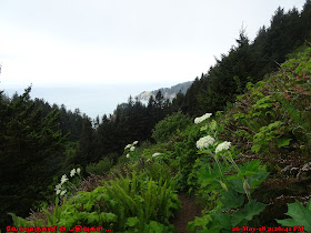
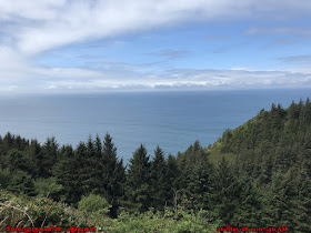
Neahkahnie Mountain is one of the highest points of 1,680 feet, on the west coast of the United States. From its location in Oswald West State Park, Neahkahnie offers stunning views of the Pacific Ocean. Tillamook Native Americans considered the mountain to be supremely significant: “Ne” translates as “place of,” and “Ekahnie” as “supreme deity.”  
Mt Neahkahnie Oswald West State Park
Mt Neahkahnie Hike Oregon
Oswald West State Park Pacific Ocean View
Mount Neahkahnie Hike Oregon

Neahkahnie Mountain Loop Hike
This coastal favorite hike will take us to the great views from the 1,680-foot summit of Mount Neahkahnie, which is part of Oswald West State Park.

·         Start point: Short Sand South Trailhead
·         End point: Neahkahnie Mountain Viewpoint
·         Distance: 8.0 miles
·         Difficulty: Moderate

The Oregon Coast Trail crosses Neahkahnie Mountain from Short Sand Beach and descends to Manzanita. This hike, mostly within the boundaries of Oswald West State Park, takes you from the majestic old growth around Necarney Creek to the clifftop views of the Devils Cauldron; then you cross meadows frequented by elk to hike up Neahkahnie Mountain to a spectacular viewpoint. 
Oswald West State Park Oregon
Oregon Coast Trail Neahkahnie Mountain
Neahkahnie Mountain Loop Hike
Neahkahnie Mt Hike Oregon
Mount Neahkahnie Oswald West State Park
we will descend to the South Neahkahnie Mountain Trailhead. From there, there's a mile and a half of road walking, including a mile and a quarter along the shoulder of busy Highway 101 (There is a path - sort of - for pedestrians), but the scenic views make the loop worthwhile. A shorter version of this loop, which knocks 2.6 miles off the total, begins at the North Neahkahnie Mountain Trailhead.

Directions to Neahkahnie Mountain Hike 
Both trailheads are reached by accessing Highway 101. The west trailhead parking is about 11 miles south of Cannon Beach, just south of milepost 40, on the west side of the highway. The trail starts across the highway. There is space for several cars here.

The south trailhead is about a mile and a half south of the west one, between mileposts 41 and 42, not quite 2 miles north of Manzinita. There is a brown hiking sign pointing to the road you need to take, which will be a left turn if you are coming from Cannon Beach.