Jan 28, 2019

Elk Flats Trail Oregon

Elk Flats Trail Oswald West State Park

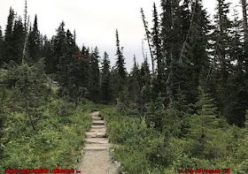
Elk Flats Trail for a 3-mile moderate to difficult hike to Short Sands Beach. The Elk Flats Trail, which leads hikers through stunning old growth trees is steep in some sections and can be muddy this time of year; be prepared to scamper over sizable fallen trees.
Elk Flats Trail Oswald West State Park
Elk Flats Trail Short Sands Beach
Oregon Elk Flats Trail
Oswald West State Park Oregon

This Hike features a great forest setting and is rated as moderate. The trail is primarily used for hiking and nature trips and is best used from April until November.


·         Difficulty: Moderate
·         Distance: 3 miles Round Trip
·         Elevation Gain: 616 feet

·         Location: Oregon Coastal Highway 101 - Oswald West State Park


Elk Flats Hike Oswald West State Park
Elk Flats Trail Oregon Coast
Elk Flats Trail Oregon

Driving Directions to Elk Flats Trail Oregon
Drive to Neahkahnie Mountain NORTH Trailhead parking area located on the west side of HWY 101, just north of milepost 40 and 1 miles south of Short Sands Beach in Oswald West State Park. Parking is limited.

Jan 23, 2019

Devils Cauldron Oregon

Devils Cauldron Trail Oregon

The Devil's Cauldron is a cliff-backed cove just south of Short Sand Beach. The ocean swells churn and froth around a handful of sea stacks, including Cube Rock, making this a spectacular view on a fine day. A viewpoint at the top of the cliffs can be reached from the nearby Elk Meadow Trail/Oregon Coast Trail.

Oregon Devils Cauldron
Devil's Cauldron Oregon Coast
Devils Cauldron cliff-backed cove

Devil's Cauldron Trail in Oswald West State Park is a 0.5 mile hiking path from the highway leads to this cliff-side cove with views of turbulent water.


·         Difficulty: Easy
·         Distance: 0.5 miles Round Trip

·         Location: Oregon Coastal Highway 101

Devils Cauldron cliff
Devils Cauldron Coastal Oregon
Devils Cauldron Trail
Devils Cauldron Oregon
Oregon Coast Devil's Cauldron


Driving Directions to Devil’s Cauldron Overlook
Drive to Neahkahnie Mountain NORTH Trail-head parking area located on the west side of HWY 101, just north of milepost 40 and 1 miles south of Short Sands Beach in Oswald West State Park. Parking is limited.

Jan 20, 2019

Short Sand Beach Oregon

Short Sand Beach Oswald West State Park

Short Sand Beach, a popular beach that’s alive with activity on any weekend or summer day, Short Sand Beach lies sheltered in a cove blanketed by forests and edged with volcanic basalt and sandstone cliffs characteristic of the Oregon coastline.   Nicknamed “Shorty’s” by locals, the beach is just a half mile walk through the woods.  
Short Sand Beach Oregon
Short Sand Beach Oswald West State Park
Oregon Coastal Trail Map
From the main parking lot, walk under Highway 101, and down the trail, following the contours of Short Sand Creek through the forest.  Cross the creek on a railroad-style bridge and you’ll find yourself at a beautiful picnic area overlooking the beach. It is one of our favorite places to surf at Short Sands Beach.

Oswald West State Park Beach
Short Sand Beach Access
Short Sand Beach Trail Oregon
Short Sand Beach Trail
Oregon Short Sand Beach

One of the best spots to visit and Surfing on the Oregon Coast. Classic views of the jagged coast with an awesome beach to soak it in. Dense green old growth forest trail along with the wide-open sandy beach 1-mile round-trip hike. After about a short walk down, the path opens into a large ocean view of the river mouth flowing into the crashing waves and massive drift wood trees stacked against the forest. This beach is also known for its fun surf in the summer.

From Short Sand Beach we can access the moderate hike to the end of Cape Falcon, or even the more robust, 6.6-mile there-and-back hike to the top of Neahkahnie Mountain. 

How To Reach : It is located just off the side of highway 101 north of Manzanita and south of Cannon Beach. To get here, you need to just pull off into the Oswald West parking lot on the ocean side of the freeway. From here, it is just a short walk through the old growth forest covered in dense green moss where you will continue and cross a wooden hanging bridge that crosses a small river that empties into the ocean.

Jan 15, 2019

Weldon Wagon Road Hike

Weldon Wagon Road Trail in Washington

The 2.5-mile historic wagon road built in the early 1900's to transport apples from the upper farmlands to the White Salmon River for transporting to markets. It is now a year-round trail with a wildflower show in the spring and great colors of vine maples and oak woodlands in autumn.
Weldon Wagon Road
Weldon Wagon Road Hike
Weldon Wagon Road Trail

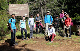
Historic Weldon Wagon Road: Settlers living on the heights above Husum used to employ sleds to ferry their produce down to "town." Apples were the prime product at that time, and they had to get to market. In the early 1900s, Elwin Weldon and Henry Hyndman built a wagon trail to lead down the slope to the White Salmon River. The road has now been converted to a hiking trail that offers expansive white oak woodland at its beginning and end as well as wide-ranging vistas in between on open slopes that bloom with balsamroot, paintbrush, and other wildflowers in the spring. Beginning on private land, the trail then accesses the White Salmon Oak Natural Resources Conservation Area.  
Best Wildflowers Hike in Washington
Mt Hood Weldon Wagon Trail
Weldon Wagon Road Hike WA

Hike Description:  To find the trailhead, walk 0.15 mile up a 4x4 road to a well-marked sign for Weldon Wagon Trail. At 1.5 miles, the trail takes you into the White Salmon Oak Natural Conservation Area. Return the way you came. At the end of the wagon road you'll find old rusted farm equipment left there to capture a feel for the past. 

The trail crosses the White Salmon Oak NRCA (Natural Resources Conservation Area), which includes 315 acres containing one of the larger and remaining forests of Oregon White Oak. The idea is to preserve the environment of the area to resemble its appearance prior to settlement.  The best time to hike this trail is in the spring, to see the wildflowers. Late April and May allows you to enjoy the spring display of the beautiful balsamroots and lupines. Also Look for the views south to Mount Hood. 

·         Hike Type: Out and back
·         Distance: 5 miles round trip
·         Elevation Gain: 1340 feet
·         Difficulty: Moderate
·         Best Season: Late April to mid-May

Weldon Wagon Trail Wildflowers
Weldon Wagon Road Trail in Washington
WA Weldon Wagon Road Hike
Weldon Wagon Road Trail WA

Directions to Weldon Wagon Trail-head:  Cross the Hood River Bridge ($2 toll). Head west onto WA Hwy 14. Drive 1.6 miles and turn right onto Highway 141 ALT. Continue 2.2 miles and turn left onto Highway 141. Go 4 miles to Husum. Turn right, before crossing over Rattlesnake Creek/Bridge, onto a gravel Indian Creek Rd. Drive 0.6 miles. Bear left onto Indian Cemetery Rd. Then continue for 0.3 miles to a 4x4 road and sign marking the Weldon Wagon Trail.

Jan 13, 2019

Reflection Lake at Mount Rainier

Reflection Lakes at Mount Rainier National Park

Reflection Lakes is one of the Roadside Attractions in Mount Rainier National Park, The Reflection Lakes that received its name from a close and full reflection of Mount Rainier in the waters. Lots of people come here to enjoy this iconic view. Reflection Lakes can also be accessed via the Wonderland Trail.

Mount Rainier Reflection Lakes
Mount Rainier Wonderland Trail
Mt. Rainier Reflection Lakes
Reflection Lake at Mount Rainier
One of the most iconic views of Mt. Rainier in the park can be found at Reflection Lakes. Summer and fall, sunrise and sunset, it is perhaps the single-most photographed view for both budding and experienced photographers, who return again and again. In summer, the lakes are bordered with wildflowers and come autumn, they are a mirror of fall color. Many consider this area to be the park at its best — colorful blooms, enchanting animal life, and scenic, awe-inspiring beauty of mountain peaks and alpine lakes.


Reflection Lake Washington
Reflection Lakes at Mount Rainier
Reflection Lakes Mt Rainier
Wonderland Trail Mt Rainier
Mt. Rainier Reflection Lake


Driving Directions to Reflection Lakes - Drive 3 miles (4.8 km) east of Paradise on Stevens Canyon Road for a possible glimpse of Mount Rainier's reflection in these sub alpine lakes.

Jan 10, 2019

Lake Quinault Olympic Peninsula

Lake Quinault in Quinault Rain Forest Washington 

Lake Quinault is a lake on the Olympic Peninsula in western Washington state. It is located in the glacial-carved Quinault Valley of the Quinault River, at the southern edge of Olympic National Park in the northwestern United States. One of the most dominant features of Lake Quinault is its location within the Quinault Rain Forest, a temperate rain forest. Lake Quinault is owned by the Quinault Indian Nation. The area is accessible from U.S. Route 101.
Lake Quinault Fishing
Washington Lake Quinault
Lake Quinault Washington
Lake Quinault offers lush rainforest groves within a short walk or drive of most creature comforts. The lake has served for decades as a popular resort destination—cabins, lodges, and stores dating from the 1920s line the southern shore, just outside the park boundary. The old-growth forests here have survived intact, though the naked tracts of clear-cut timber along US-101 north. 

·         Area activities include fishing (with permit from the Quinaults),
·         scenic drives (a loop around the lake is longer than 30 miles),
·         and Hiking - southern side of the lake has short hiking trails maintained by the U.S. 

Lake Quinault in  Quinault Rain Forest
Lake Quinault Olympic Peninsula
Quinault Rain Forest

The Quinault Valley is a wilderness gateway to alpine meadows, jeweled lakes and ice-carved peaks. For shorter visits, the valley has a scenic loop drive and short trails through temperate rain forest in both Olympic National Park and Olympic National Forest.

Directions to Lake Quinault :
Quinault is located in the southwestern area of the park, about a three-hour drive from Port Angeles and one hour from Forks

Jan 8, 2019

Nisqually Vista Trail

Nisqually Vista Trail Mt Rainier National Park

Nisqually Vista Trail is a 1.2 mile lightly trafficked loop trail located near Paradise Inn, Washington that features beautiful wild flowers and is good for all skill levels. The trail is primarily used for hiking, walking, nature trips, and snowshoeing and is best used from June until October.
Nisqually Vista Trail
Mt Rainier National Park Nisqually Vista
Nisqually Glacier and River Mt Rainier
The trail-head is located at the northwest end of the lower parking lot. Suitable for families with strollers.

·         Area: Paradise
·         Hike Type: Family-friendly    
·         Parking Pass / Entry Fee: Natl. Park Pass
·         Distance: 1.2 mi Loop   
·         Duration: 45 Minutes  
·         Difficulty Level: Easy
·         Elevation Gain: 200
·         Snow-Free Time: Mid-July – Mid-Sept        

Hike Description: Nisqually Vista Trail has an old paved path that winds through lush meadows and stands of Pacific silver fir, subalpine fir, and mountain hemlock to eventually reach several overlooks with panoramic views of the quickly retreating Nisqually Glacier and Mount Rainier itself.
·         Panoramic vistas of Mount Rainier,
·         Nisqually Glacier and River.
·         Views of the Nisqually Glacier.
·         Easy hike suitable for all visitors.

Go left at the junction to Nisqually Vista. The trail climbs briefly then descends to another signed junction. You have a choice here; either direction takes you in a loop. If you wish to save the best viewpoint for last, go straight and walk the gently descending path counterclockwise, passing a few viewpoints along the way.
Mount Rainier Paradise Trails
Nisqually Vista Trail Mt Rainier Natl Park
Nisqually Vista Trail Mt Rainier

At the farthest point (just over 0.5 mile) is the best and final viewpoint, with an interpretive sign describing the Nisqually Glacier. The glacier has receded greatly over the years, leaving what looks like an elongated gravel-covered mound, far smaller than it used to be. The bottom, or snout, of the glacier has a nearly vertical face, where melt-water from above washes over and erodes it
Nisqually Vista Mt Rainier

How To Reach: Enter the west (Nisqually) entrance to Mount Rainier National Park, 13.5 miles east of Elbe on State Route 706. Drive 17 miles to the lower parking lot at Paradise. Park here. 300 yards further is the Visitor Center and upper parking lot.