Nov 25, 2018

Portland Japanese Garden

Portland Japanese Garden

The Portland Japanese Garden sits nestled in the hills of Portland, Oregon’s iconic Washington Park, overlooking the city and providing a tranquil, urban oasis for locals and travelers alike. Designed in 1963, it encompasses 12 acres with eight separate garden styles, and includes an authentic Japanese Tea House, meandering streams, intimate walkways, and a spectacular view of Mt. Hood. This is a place to discard worldly thoughts and concerns and see oneself as a small but integral part of the universe.

Portland Japanese Garden
Entry cascading ponds  in Japanese Garden
Japanese Garden Portland Oregon

Features of Portland Japanese Garden
The 12 acre Portland Japanese Garden is composed of eight garden spaces and a Cultural Village.
The Strolling Pond Garden is the largest and contains multiple areas. A creek flows under a moon bridge to connect the upper and lower ponds. The lower pond is home to many koi and a viewpoint for the beautiful Heavenly Falls. There is a 100-year-old five-tiered pagoda lantern, a gift from Portland's sister city of Sapporo with ornamental rocks forming the shape of Hokkaidō island and a red stone for Sapporo.
The Natural Garden has multiple ponds, waterfalls, and streams. Trees, shrubs, ferns, and mosses grow in their natural state.
Japanese Garden Portland
Japanese Natural Garden Oregon
Japanese Natural Garden Portland

The Sand and Stone Garden contains weathered stones rising from rippled sand suggestive of the water. The tranquil rake patterns are often present in karesansui (Japanese rock gardens).
The Flat Garden is typical of a daimyō (feudal lord)'s villa garden, and its Pavilion is reminiscent of the Kamakura period architectural style. Raked white sand represents water and vividly contrasts with maple trees, moss, evergreens, and azaleas.
The Tea Garden has two areas, each devoted to enhancing the tea ceremony: an outer waiting area and an inner garden surrounding the authentic tea house, constructed in Japan by Kajima Construction Company and assembled onsite in 1968.
The Entry Garden is home to a series of cascading ponds welcome visitors. The garden continues along a zigzagged walk up a terraced stone pathway through towering firs and cedars growing naturally along the hillside.
Japanese Natural Garden Portland
Modern Japanese garden Portland
Oregon Japanese Natural Garden
Tsubo-Niwa Japanese garden

The Ellie M. Hill Bonsai Terrace provides a space for the Garden to showcase seasonal bonsai specimens. The Garden partners with local bonsai practitioners in Portland and from around the region, giving visitors a chance to see a variety of bonsai examples and techniques.
The Tsubo-Niwa is a modern Japanese garden style. This tiny "vignette" garden incorporates the essential elements of a Japanese garden – stone, water, and plants – while placing nature as a central focus of the surrounding Cultural Village.

How To Reach : The Japanese Garden is close to Washington Park's main entrance, at the top of Park Place, just above and a short walk from the International Rose Test Garden.
Parking inside Washington Park costs $2 per hour, to a maximum of $8 per day.  
TriMet bus route 63-Washington Park stops nearby and runs every day. The Washington Park Shuttle which connects the Washington Park MAX light rail station to the Japanese Garden daily from May through September, and on weekends in April and October. Once at the garden, there is a shuttle that runs up the hill frequently.
Address: 611 SW Kingston Ave, Portland, OR 97205

Nov 18, 2018

Bald Butte Hike Oregon

Bald Butte Hike in Mt Hood National Forest

Bald Butte Trail is an 8.8 mile lightly trafficked out and back trail located near Mt Hood, Oregon that features beautiful wild flowers and is rated as moderate. The trail offers a number of activity options and is accessible year-round. In addition, it has truly unique views of Mt. Hood.  Great in the spring for wild flowers.
Bald Butte Trail Wild Flower Hike Oregon
Oregon Wild Flowers Hike
Mount Hood View from Bald Butte
This is a quiet all-season trail that offers a variety of terrain (Snowshoes need to be worn in winter). Large open meadows, heavily wooded mixed forest, and a ridge-top ramble take you to a former lookout site with spectacular views of the Hood River Valley. This hike uses two different trails; it's a 2.3 mile climb up the Oak Ridge Trail; then it's 1.8 miles on the Surveyors Ridge Trail to Bald Butte. Late spring is the best time to visit: that's when the shady woods, the open slopes on the Oak Ridge Trail, and the meadows atop Bald Butte come alive with wildflowers. Bear in mind that ATVs also access Bald Butte via the power line corridor, and mountain bikers ride the Surveyors Ridge Trail.

·        Start point: Oak Ridge Trail-head Road
·        End point: Bald Butte
·        Hike Type: Out and Back
·        Distance: 8.2 miles round trip
·        Elevation gain: 2465 feet
·        High point: 3,779 feet
·        Difficulty: Moderate
·        Seasons: All, but will require snowshoes in the winter

The hike begins on Hood River County property and travels on Oak Ridge Trail #688A through a former clear-cut with young ponderosa pines, oaks and shrubs, such as serviceberry and flowering currant. Cross a road and switchback up three times in woods, make a traverse and switchback again. There’s another switchback at a meadow and then four more switchbacks in oak-fringed meadows. The trail enters Douglas-fir, ponderosa pine, and oak woodland. Keep rising, and enter an open area with a view of Mount Hood.
Bald Butte Hike Portland
Bald Butte Hike in Mt Hood

Mt Hood National Forest Bald Butte

Bald Butte Trail Wildflower Hike
Balsamroot and Columbia desert parsley (Lomatium columbianum) bloom here in the spring. There are several short switchbacks as you continue up the slope and enter mixed forest again. Pass a wooden gate and a fence line, and then switchback five more times into an open area with another full-on view of Mount Hood. Traverse up and switchback three more times in a forest of Douglas-fir, grand fir, and ponderosa pine with a carpet of Oregon grape. You will see the gray-green clumps of mistletoe on some of the branches. The trail crosses the 640 spur road, and reaches the Surveyors Ridge-Oak Ridge Trail Junction.
Arrowleaf balsamroot Hike
Balsamorhiza and  Columbia desert parsley

Turn left on the Surveyor's Ridge Trail #688, and head gently down. The trail recrosses the road and a sign tells you that you’re leaving National Forest land. Enter an area of clear-cuts where chinquapin bushes line the trail. The path continues to drop a little. Below are rocky palisades offering views across the Hood River Valley. The trail drops further to a saddle where the power lines come across in a wide clear-cut corridor.

There are great views of the Hood River Valley across to Mount Defiance. The trail levels as you enter shady Douglas-fir woods. Drop down to another saddle and then, on open meadows, hike up a rubbly track to the open area at the top of Bald Butte. On a clear day, there are great views to Mount Hood and the Cascade crest in Washington: Mount Saint Helens is fully visible and Mount Adams lurks behind the Butte.

Note: It is possible to turn this hike into a loop by returning via the power line road, which will take you back to the Oak Ridge Trail near the parking area.
Bald Butte Hike Oregon
Oregon Bald Butte Hike

How to Reach : Drive I-84 east to Hood River and take Exit 64 for White Salmon and Government Camp.
Turn right, and then right again immediately. Drive 0.3 miles to a four-way stop. Keep straight here on Highway 35 South for Odell, Parkdale and Mt. Hood.
Drive 15 miles and turn left on Smullin Road (the sign may be hidden behind tree branches), which is one mile past the Hood River Ranger Station.
Drive 0.3 miles and make a left onto a gravel road. Park in the circular parking area here.

Nov 11, 2018

Portland Pittock Mansion

Pittock Mansion Historic House Museum Portland

Pittock Mansion is a historic house museum in Portland, Oregon operated by Pittock Mansion Society in collaboration with Portland Parks & Recreation. Pittock Mansion Society is a non-profit organization. The mission of the Pittock Mansion Society is to inspire understanding and stewardship of Portland history through Pittock Mansion, its collections, and programs.

Oregon Pittock Mansion
Pittock Mansion Central Heating System
Pittock Mansion Historic House

Pittock Mansion is a 16,000 square foot French Renaissance style home. It was designed by architect Edward T. Foulkes who trained at the Massachusetts Institute of Technology and the French École des Beaux-Arts. Foulkes had a challenging client in Henry Pittock—Henry wanted an architecturally impressive house with the latest technology.  The building was added to the National Register of Historic Places in 1974.

Pittock Mansion Fun Facts
·         Architectural style - Italianate, Renaissance
·         Location - Portland, Oregon, U.S.
·         Ground Size - 46 acres
·         Construction started in 1909
·         Completed in 1914

The Mansion was designed to capture the view of downtown Portland and the Cascade Mountains.  As a result, it has a unique oval shape with wings attached at a 45 degree angle. The Mansion’s 23 rooms include a Library, Music Room, Turkish Smoking Room, Sewing Room, five large bedrooms, and two sleeping porches. The curved wooden floors in the Mansion’s round and oval rooms are one of its many artistic features. Foulkes’ experience designing commercial buildings helped him fulfill the task of including modern conveniences such as thermostat-controlled central heating, indirect electric lighting, refrigerator room, elevator, and central vacuum system.

Pittock Mansion Oregon
Pittock Mansion Portland
Portland Pittock Mansion
Portland View from Pittock Mansion

How To Reach : Visitors can drive up to the mansion in NW Pittock Drive. The Wildwood Trail through Forest Park also crosses the mansion's parking area, allowing hikers to arrive at Pittock Mansion on foot.
Address : 3229 NW Pittock Drive, Portland, OR 97210

Nov 10, 2018

Hart's Cove Hike Oregon

Hart's Cove Scenic Hike in Oregon Coast

Harts Cove Trail is within Siuslaw National Forest. It is 2.7 miles long and begins at 900 feet altitude. Traveling the entire trail is 5.4 miles with a total elevation gain of 1,275 feet.
Hart's Cove Hike Oregon Coast
Harts Cove Trail Cascade Head
Hart's Cove Hike in Oregon Coast

This scenic trail descends about 900 feet in elevation through a Sitka Spruce-Western Hemlock rain forest, crosses two seasonal creeks and ends at a prairie headland overlooking the Pacific Ocean. Chitwood Falls cascades off the backside cliff at Hart's Cove. An unseen cove to the south resounds with the barking of sea lions. The strenuous trail traverses steep forested hillsides to a grassy meadow on the ocean’s edge.

Hart's Cove is part of the Cascade Head Marine Reserve and Marine Protected Areas. And the trail is closed seasonally from Jan. 1 through July 15 to protect endangered species.

·        Start point: Harts Cove Trailhead
·        End point: Harts Cove Overlook
·        Hike Type: Out and back
·        Distance: 5.4 miles round trip
·        Elevation gain: 1000 feet
·        Difficulty: Moderate
·        Trail open only on : July 16th to December 31st

The trail loses over 900 feet of elevation as you hike from the trailhead to the shore of the coast, with the steepest section in the first half mile. Most of the hike is through a dense coastal rainforest of Sitka spruce and western hemlock with a thick understory of ferns and moss.
Hart's Cove Trail head Cascade Head
Hart's Cove Scenic Hike
Hart's Cove Trail Meadow
Harts Cove Hike in Oregon Coast
The trail crosses two creeks: the first is Cliff Creek with a sturdy wood bridge, and the second is a bridgeless crossing of Chitwood Creek. The former bridge was washed out and still laying in the creek just down from the crossing. Sea lions can be heard barking loudly, but we never did see them.

Just under 2.5 miles in, the trail breaks out of the forest onto a large, steep meadow with incredible views of the ocean, and at this point you can finally see the sea lions you could hear in the forest previously, as they are all generally sitting out on the rocks in the ocean below the visible ridge to the south. If you descend through the meadow, you'll be rewarded with a view of Hart's Cove, which has a beautiful waterfall cascading into the emerald green waters of the ocean below

In the large meadows, Follow a side trail to a spectacular view of Hart’s Cove, with Chitwood Creek cascading as a waterfall into the ocean. The water is a deep blue-green color, with waves crashing against the steep cliff walls of the cove.
Scenic Hikes in Oregon Coast
Harts Cove Hike in Oregon

How to Reach: Take Highways 18 towards the Oregon Coast 47.0 miles past Otis, then bear right for Highway 101 North. In 0.2 miles, turn right on Highway 101 North and drive another 3.8 miles up onto forested Cascade Head. You’ll turn left on an unsigned gravel road through an open gate. Keep left at a fork after 2.5 miles, and then look for a Nature Conservancy Trailhead on the left. It’s another 0.8 miles to the trailhead for Hart’s Cove.


Nov 5, 2018

Trillium Lake Mt Hood

Trillium Lake in Mount Hood National Forest

Trillium Lake is situated 7.5 miles (12.1 km) south-southwest of Mount Hood in the U.S. state of Oregon. It is formed by a dam at the headwaters of Mud Creek, tributary to the Salmon River. It was created by the state Department of Fish and Wildlife in 1960.
Mt Hood Trillium Lake
Mount Hood View from Trillium lake
Mount Hood National Forest Lake

The lake is popular for fishing, camping and photography, often clearly reflecting Mount Hood. Adjacent Trillium Lake Campground is administered by the Zigzag Ranger District of the Mount Hood National Forest. Be sure to bring your camera to Trillium lake as it hosts breathtaking views of Mount Hood which are best observed during sunrise and sunset.  During the warmer months Trillium lake is great for swimming though the water can be cold at times due to its high elevation and nearby snow melt.  There is a short trail that runs around Trillium lake which is great for a quick hike or jog and runs about 2-3 miles. 
Trillium Lake Oregon
Trillium Lake Camp grounds
Oregon Trillium Lake
Trillium Lake in Mount Hood National Forest
Trillium Lake Campground is a beautiful and popular campground not far from the quaint town of Government Camp. It provides spectacular views of majestic Mt. Hood, Oregon's highest point. The campground is well-known for its scenery and abundant recreational opportunities, as well as being a great, family-friendly place to camp.

Trillium Lake Campground is located just minutes from Government Camp off of Highway 26 in the beautiful Mount Hood National Forest. The campground sits on the east side of the lake with some campsites nestled up near the shore the lake and others more inland lacking in lakeside views.  The campground is very popular and can fill up during peak season so be sure to either make reservations or show up early to grab a site.  There are two loops at the campground featuring 52 single sites and 5 double sites.  There is a day use area at Trillium lake near the dam with a $5 per vehicle fee.  No motorized boats are allowed on trillium however there is a nicely paved boat launch for human powered boats. 

The Trillium Lake is located about 40 miles southeast of Portland, in the Mt. Hood National Forest. It sits at an elevation of 3,600 feet, and is nestled in a shady, mixed conifer forest.

Nov 4, 2018

Sauvie Island Portland

Sauvie Island in Columbia River, Portland 

Sauvie Island is approximately 13 miles from downtown Portland, Oregon, and has 24,000 acres offering a variety of outdoor activities. Accessibly by the Sauvie Island Bridge, the island has a rural, relaxed way of life and is home to family farms and wilderness preserves that attract more visitors each year.
Oregon Nude Beach
Portland Sauvie Island
Sauvie Island Public Beach Access

Sauvie Island Fun Facts :
·       Originally it is called as Wapato Island or Wappatoo Island.
·       Largest island along the Columbia River, at 26,000 acres (10,522 ha).
·       It is one of the largest river islands in the United States.
·       The beaches open at dawn and close at 10 p.m

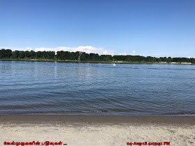
Sauvie Island has five beaches open year-round: Walton, Warrior Point, Collins, Reeder and North Unit. It lies approximately ten miles northwest of downtown Portland, between the Columbia River to the east, the Multnomah Channel to the west, and the Willamette River to the south.
Sauvie Island in Columbia River
Sauvie Island Oregon
Sauvie Island Public Beaches
Sauvie Island Reeder Beach
Sauvie Island Collins Beach

Sauvie Island Portland

Sauvie Island Public Beaches
Reeder, North Unit, Walton, Collins and Warrior Point public beaches are located along the island’s north/east coast (Columbia River). Travel along NW Reeder Road’s last few miles past the end of the pavement (approx 4 miles down the road from Reeder Beach). Walton Beach and Warrior Point Beach are located on the north side of the island in Columbia County.  Warrior Point Beach is accessible by boat or a 3.5 mile hike from the end of Reeder Road. And the Collins Beach has optional clothing.

Parking Permits
A daily pass is $10.00; an annual permit is $30.00 is needed. Be sure to place this on your dash when you park at the beach. Open from dawn to 10:00 p.m., and closed to overnight use and camping.
Note: If you have not already purchased, you will need to do so. They are available at the general store at the base of the bridge as you cross the river channel.