Nov 26, 2017

Martha Falls Trail in Little River Canyon

Martha's Falls Trail in Little River Canyon National Preserve

Martha's Falls, formerly Little Falls is a popular swimming area at Little River Canyon National Preserve. Little River Canyon National Preserve is a United States National Preserve located on top of Lookout Mountain near Fort Payne, Alabama, and DeSoto State.
Martha Falls Trail Little River
Alabama Martha Falls
Little Canyon National Park Alabama
The Martha’s Falls Trail starts at the back of the Little River Falls parking lot. If you are on the Little River Falls Overlook boardwalk and viewing the falls, when hiking back, take the gap in the fence and proceed down the trail to the right. 

Length: 1.5 miles round trip
Type of Hike: Out and back
Time: 1 hour, not counting stopping at the falls to swim or relax on the riverbank
Difficulty:  Easy to Moderate with a steep downhill / uphill climb over rocks, serious injury possible
Points of Interest: Little River Falls (at trailhead) and; Martha's Falls is a popular swimming spot. 

Little River Canyon National Park
Little River Canyon National Preserve
Martha Trail in Little River
Martha Falls from Little River Falls Overlook
Most of the trail is flat, but often very rocky, making it difficult to breeze along. In addition, it often appears to peter out, which may lead to moments of backtracking to make sure you didn’t miss anything. This is most problematic when the trail turns nearly to all rock, making it harder to follow the path as compared to when it is cut through the dirt. As a rule of thumb, as long as you are hiking along the river (far below), you are on the Martha’s Falls Trail . Parking is available off Highway 35, near Road 861.
Little River Falls in Little River
Marthas Falls Trail in Little River
Address: Little River Canyon National Preserve, 4322 Little River Trail NE #100, Fort Payne, AL 35967

Nov 23, 2017

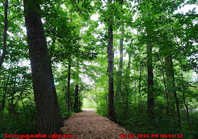
Wilson Trail Sapsucker Woods Sanctuary

Cornell Lab of Ornithology Sapsucker Woods - Wilson Trail

Sapsucker Woods Sanctuary  is located in the beautiful 220-acre inside the Cornell Lab Area, The Cornell Lab of Ornithology is a world leader in the conservation, appreciation, and study of birds. It is also a popular tourist site with a number of attractions and activities. 
Cornell Lab of Ornithology Sapsucker Woods
Sapsucker Woods - Wilson Trail
Sapsucker Woods Sanctuary Hiking and Bird Watching
Hike wooded trails, learn about rare and endangered birds and watch fascinating movies in the observatory. A sanctuary for learning and discovery, this popular Ithaca attraction is a one-of-a-kind haven for nature enthusiasts.
Cornell Lab of Ornithology  Sapsucker Woods - Wilson Trail
Sapsucker Woods Sanctuary Trail
Sapsucker Woods Sanctuary
The Cornell Lab of Ornithology Trail
The Cornell Lab of Ornithology
Founded in 1915, the Cornell Lab is a nonprofit organization supported by 100,000 friends and members. Our vibrant community includes 400,000 citizen-science participants from all walks of life and 14 million bird enthusiasts of all ages who connect with us online at All About Birds.

Admission is:             Free
Activity Type: Bird Watching
Nearby City:   Ithica
Length:           0.75
Trail Type:      Loop/Lollipop
Skill Level:     Easy
Best Times:    Best Spring through Fall

If you know anything about birds, you've most likely heard about the Cornell Lab of Ornithology. Its reputation is world-renowned. We're fortunate to have it in our region of New York State. Its research facilities and on-going programs involving the public have a dramatic impact on helping birds.

A few of these programs are:

Project Feeder Watch—People monitor their backyard feeders and provide information on bird visits to the lab.
The House Finch Disease Survey—People monitor the house finch and other birds for an eye disease and give relevant data to the lab.
This is often done in conjunction with Project Feeder Watch.
The Birdhouse Network—This is a monitoring program for bird nest boxes, such as those on bluebird trails.
Birds Likely Seen: Ducks, geese, finches, robins, warblers, woodpeckers, nuthatches, chickadees, titmice, vireos and thrushes.
Wilson Trail - Hiking and Bird Watching
Wilson Trail Cornell Lab of Ornithology
Wilson Trail Sapsucker Woods

Cornell Lab of Ornithology, 159 Sapsucker Woods Rd. Ithaca, NY 14850
Hours - Visitor Center open from 10:00 a.m. to 4:00 p.m. daily (Trails in Sapsucker Woods Sanctuary are open daily, dawn to dusk)

Nov 22, 2017

Ithaca Falls on Fall Creek

Ithaca Waterfalls on Fall Creek, New York

Ithaca Falls is a massive jumble of irregular cascades and a few overhanging drops. It is 105 feet high and 175 feet wide. The top has a small dam, a remnant from when the falls was used to generate power. The dam is estimated at 10 ft high. Best time to visit the falls is Year-round.
Ithaca Falls Waterfalls on Fall Creek NY
Ithaca Waterfalls Natural Area
Ithaca Falls is most definitely the symbol of Ithaca, New York, a city settled within the crossroads of deep gorges, bordered by acclaimed colleges, and rife with manufacturing history. The waterfall itself is massive. Towering over 100 feet tall and stretching nearly 175 ft across at its base, it can fill the adjacent neighborhood and Cornell’s western flank with a thunderous roar in spring. By autumn the frothy cascade slows and students take to the banks to read or practice photography among the turning leaves.
Ithaca Falls on Fall Creek NY
Ithaca Waterfalls New York
Ithaca Waterfalls NewYork
NY Ithaca Falls on Fall Creek
Trail Info - Easy trail, with the best view of the falls from the bridge over Lake Street or the foot path adjacent to the creek. The Trail is open year-round.

Directions to Ithaca Waterfalls : From downtown, take Aurora St. north 0.7mi to Lincoln St. Turn right, then take an immediate left onto Lake St. The falls will be on your right. Park on nearby city streets or the small lot adjacent to the falls.

Location: On the south end of Cayuga Lake; In the city of Ithaca, Tompkins County, New York.
Ithaca Falls New York
Ithaca Falls Natural Area
From Rt 13 in Ithaca, take Seneca St east to Stewart Ave. Take a left (north) on Stewart and follow it into the Cornell University Campus. Turn left onto University Ave and cross into Lake St.  Lake turns left, then right.  You will be able to see Ithaca Falls on the right, but that also means you passed the parking area.

Nov 18, 2017

Taughannock Falls

Taughannock Falls in New York

Taughannock Falls State Park is a 750-acre (3.0 km2) state park located in the Town of Ulysses in Tompkins County, New York in the United States. The park is northwest of Ithaca near Trumansburg. The park's namesake, Taughannock Falls, is a 215-foot (66 m) plunge waterfall that is the highest single-drop waterfall east of the Rocky Mountains. 
Taughannock Falls in New York

Taughannock Falls main cataract is a 215-foot drop (66 m), making it 33 feet (10 m) taller than Niagara Falls. It is the tallest single-drop waterfall east of the Rocky Mountains. The waterfall is located along Taughannock Creek, which flows through a long gorge with cliffs up to 400 feet (120 m) high. Taughannock Falls is part of the popular Finger Lakes Region of central New York.
Taughannock Falls State Park


Taughannock Falls State Park offers hiking and nature trails, camping and picnicking. The park includes a stretch of Cayuga Lake's shoreline, where swimming, fishing, and a boat launch are available. In the winter, the park offers facilities and trails for ice-skating, sledding, and cross-country skiing. 
Taughannock Waterfalls New York
Views of Taughannock Waterfalls are available from two trails. They may be viewed from below by walking along the 1-mile-long (1.6 km) there-and-back-again Gorge Trail, which also passes by Lower Falls, or they may be seen from above by following the 2.6-mile (4.2 km) Rim Trail, a loop hike which also offers views of Upper Falls. The Gorge Trail is open all year long, unlike the Rim Trail which is closed to the public in winter. Swimming under the waterfall is hazardous and strictly forbidden.

Nov 15, 2017

Pixley Falls Boonville

Pixley Falls in Pixley Falls State Park  

Pixley Falls State Park is a 375-acre New York state park located in the town of Boonville in Oneida County, New York, United States. The park is located on New York State Route 46 and is 18 miles (29 km) north of Rome and six miles (9.7 km) southwest of Boonville, near the community of Hurlbutville. 
Pixley Falls New York
Pixley Falls State Park NY
Open all year, the park gets its name from a 50-foot (15 m) waterfall called Pixley Falls, accessible via a short hiking trail. The park offers picnicking, a nature trail, hiking, fishing, seasonal hunting, and cross country skiing. The park has steep wooded hills, a mountain trout stream, and a trail that runs along the ruins of the 19th-century Black River Canal. 
Pixley Falls Boonville
Pixley Falls Creek Boonville
Pixley Falls Hike NY
Pixley Falls Nature Trail

Pixley Falls is scenic 50-foot waterfall is the main attraction at this scenic park Also has steep, wooded hills & a mountain stream and nature trail.


Pixley Falls Nature Trail is a 1.2 mile easy loop trail located near Boonville, New York that features a waterfall and is rated as moderate. The trail offers a number of activity options and is accessible year-round. Dogs are also able to use this trail but must be kept on leash.
Pixley Falls State Park New York
Pixley Falls Boonville NY
Pixley Falls State Park, 11430 State Route 46, Boonville, NY 13309

Nov 11, 2017

Toccoa Waterfalls Georgia

Toccoa Waterfalls North of Georgia

Toccoa Falls is a waterfall with a vertical drop of 186 feet (57 m), on the campus of Toccoa Falls College in Stephens County, Georgia. Toccoa was the Cherokee word for "beautiful" and Toccoa Falls is one of the beautiful waterfalls of North Georgia. 
Georgia Toccoa Waterfalls
Georgia Waterfalls - Toccoa Falls
North Georgia waterfalls
Toccoa Falls Collage Georgia

From the parking, an easily accessible pathway leads to Toccoa Falls, a 186-foot, free-falling waterfall on the campus of Toccoa Falls College.

Toccoa Waterfalls Trail
Toccoa Falls Georgia
Toccoa Waterfalls Georgia
Toccoa Waterfalls Near Atlanta


Directions to Toccoa Waterfalls : Nestled in the foothills of the Great Smoky Mountains, 95 miles north of Atlanta, Georgia, and 65 miles south of Greenville, South Carolina, is Toccoa Falls. It is located on the campus of Toccoa Falls College.

Nov 8, 2017

Minnehaha Falls Georgia

Minnehaha Waterfalls Georgia

Minnehaha Falls is a series of cascades located on Falls Creek in Rabun County, Georgia. The waterfalls descend about 100 feet over a stepped rock formation. The falls are near Lake Rabun, within the boundaries of the Chattooga River Ranger District of the Chattahoochee National Forest.
Georgia Minnehaha Falls
Minnehaha Falls in Lake Rabun
The falls are named for Minnehaha, a fictional character in the epic poem The Song of Hiawatha.  Minnehaha Falls spills over a cliff in a gorgeous, multi-tiered falls before continuing downstream to the Lake Rabun shore. It is one of the most picturesque water falls in Rabun County Georgia. It is a series of cascading falls.
GA Minnehaha Falls  Hike
Minnehaha Falls Trail Georgia
Georgia Must See Waterfalls
The falls can be reached by a short trail (0.4 miles) from Bear Gap Road called the Minnehaha Trail. The trail is maintained by the U.S. Forest Service. It is an easy to moderate hike. It starts out with stairs across the street from the parking area. There is no parking fee, so it is free to visit.
Minnehaha cascading waterfall Near Atlanta
Minnehaha Falls Near Clayton GA
Minnehaha WaterFalls Georgia
Directions to Minnehaha Falls : Take HWY 441 toward Clayton. After crossing the Tallulah Falls Bridge, go 1.7 miles and turn left onto Old HWY 441. Proceed 2.5 miles and turn left onto Lake Rabun Road. Travel 5 miles to Rabun Beach Campground.

From the Area 2 campground entrance, continue west on Lake Rabun Road for 1.6 miles. Turn left onto Low Gap Road for 0.2 miles. Make another left onto Bear Gap Road and proceed 1.6 miles to the Minnehaha Trail. Follow the trail 0.4 miles to the falls. Parking near the trailhead is very limited to 3-4 vehicles.