Oct 30, 2016

Anna Ruby Falls

Anna Ruby Falls, Helen Georgia - Unicoi State Park

Anna Ruby Falls is located in the Chattahoochee National Forest and are readily accessible for the price a few dollars and a little bit of hiking. The water cascading over the drop offs is created by two creeks. 
Curtis Creek falls  York Creek falls
Georgia Twin Falls in Unicoi State Park
Georgia Unicoi State Park
The Curtis Creek falls drop 153 feet and the York Creek falls are a much shorter but still spectacular 50 feet. The water at the bottom of the falls is then considered to be part of Smith Creek which flows into and forms Smith Lake - the centerpiece of Unicoi State Park.
Helen Anna Ruby Falls
Smith Creek Trail Unicoi State Park
Anna Ruby Falls Helen
We can reach the falls via half mile paved trail (Anna Ruby Falls Trail) that leads from the parking lot to two viewing decks. From there you get a nice view of both falls. More adventurous hikers can also walk the 4.6-mile Smith Creek Trail, which connects the base of Anna Ruby Falls to Unicoi State Park.
Anna Ruby Falls Helen Georgia Unicoi State Park
Anna Ruby Falls Chattahoochee National Forest
The 0.15-mile Lion's Eye interpretive trail near the visitor center and craft shop is available for persons with visual and physical disabilities. It is one of the most visited waterfalls in North Georgia. State Park Admission fees is 3$ , Hours of operation - 9:00am - 7:00pm

Oct 26, 2016

Anna Ruby Falls Trail

Anna Ruby Falls Trail - Unicoi State Park

Anna Ruby Falls Trail is paved but relatively steep. Benches are located along the trail, and two observation decks offer a beautiful view of the twin falls of York and Curtis Creeks.
Anna Ruby Falls Trail Georgia
Georgia Twin Waterfalls
Anna Ruby Falls Trail
Anna Ruby Falls located in the Chattooga Ranger District, these twin waterfalls from Curtis Creek (150 feet) and York Creek (50 feet) merge to form Smith Creek. These falls are reached by a scenic half-mile interpretive trail that parallels Smith Creek and ends the base of the falls. Ranger District: Chattooga, Length: 0.4 mile
Unicoi State Park Georgia
Smith Creek Helen GA
Anna Ruby Falls Helen
Anna Ruby Falls Helen Georgia
Anna Ruby Falls Trail - Unicoi State Park
How to Reach: Take GA 75 northeast from Helen for l mile to Roberts town. Turn right (northeast) on GA 356 for 1.5 miles and left on the entrance road at the sign through Unicoi State Park. Follow signs for 3.5 miles to parking area.


Note: A parking fee is charged to access the Anna Ruby Falls area. The trail can be accessed from the parking lot.

Oct 22, 2016

Panther Creek Falls

Panther Creek Falls in Georgia

Panther Creek Falls is a small and beautiful falls, it was not very big, but spacious enough that we can just swim at the bottom, or hang out near the falls. Located just north of Clarksville in northeast Georgia, Panther Creek Falls can be access only through the trail which is a 3.5-mile hike from the trailhead on Hwy 441.
Chattahoochee National Forest Panther Creek Falls
Panther Creek Falls Georgia
Panther Creek  Georgia
Panther Creek Falls Trail is a well maintained, 7-mile roundtrip trail that’s great for families or for hikers looking for a relaxing half day adventure. The Panther Creek Falls main falls is 40 feet high, but is wide and impressive. The pool of water at the base is great for swimming and the falls itself can be explored along the base. Be careful not to climb the falls; this is very dangerous.
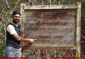
Panther Creek Trail to Yonah Dam
Upper Panther Creek Falls Georgia
Waterfalls Chattahoochee National Forest
Panther Creek Falls Near Georgia
Travelling north on 441, look for the sign on the right of the highway for Panther Creek Recreation Area indicating a left turn onto Glen Hardman Rd. Make a right on Old Hwy 441 for 1 mile. Parking is on both sides of the road. Note: Time Stamp shows in the image is IST Time Zone

Oct 20, 2016

Panther Creek Trail

Panther Creek Falls Trail in Georgia

Panther Creek Trail is a 7 mile heavily trafficked out and back trail located near Turnerville, GA that features a waterfall and is rated as moderate. The trail offers a number of activity options and is accessible from March until October. The entrance to the trail on Panther Creek is on Old Historic 441 in north Georgia, northwest of the town of Ellijay.
Panther Creek Trail in Georgia
Georgia Trails - Panther Creek Trail
Mini Falls in Panther Creek Trail
Panther Creek Falls Trail is an interior hiking trail in Georgia's Cohutta Mountains, in Fannin County, northwest of Ellijay, at the southern end of the Smoky Mountains. The trail falls within the 35,000-acre Cohutta Wilderness, part of the Wilderness's 87 mile (140 km) trail system. As an interior trail, Panther Creek Falls cannot be accessed by road, but only via other hiking trails. Eastern access is via the East Cowpen Trail, and its western access via the Conasauga River Trail. The trail starts at the confluence of Panther Creek and the Conasauga River.
Panther Creek Falls Atlanta
Panther Creek Falls Camp Ground
Chattahoochee National Forest Panther Creek
Panther Creek
Panther Creek Falls Trail
Total distance of the trail is roughly 3.5 miles (5.6 km). Campsites are located approximately 1.5 miles (2.4 km) down the trail. The trail runs along an old railroad line for the first mile, then climbs through a boulder field to the top of Panther Creek Falls, where one achieves a panoramic view of the Conasauga River Valley. From the falls, the trail climbs to its eastern termination at East Cowpen Trail.


To Panther Creek Falls Trail head: Located just north of Clarksville in northeast Georgia, Trailhead access is on SE side across US Hwy 441.

Note: Time Stamp shows in the image is IST Time Zone

Oct 17, 2016

Helton Creek Falls

Helton Creek Falls in Georgia

Helton Creek Falls is a series of two waterfalls located within the Chattahoochee National Forest in Union County, Georgia. Gorgeous! Helton Creek is a wonderful place to spend the day. This very short and easy trail takes you to two beautiful waterfalls.
Falls in Vogel State Park
Upper Helton Creek Falls Georgia
Helton Creek Road in Vogel State Park
Helton Creek Falls has some pretty sensational views. The Upper Falls is a popular hangout and swimming hole for the locals. And the lower falls, where people have brought tubes or yoga mats to slide down the rocks into the water.  
Lower Helton Creek Falls
Clear Helton Creek from the Falls
Helton Creek Falls in Vogel State Park
Upper Helton Creek Falls
Upper Helton Creek Falls observation deck
To reach these falls go north from Dahlonega on US19 21.5 miles to Neels gap. Go another 1.7 miles to Helton Creek Rd. on the right. Follow Helton Creek Rd. 2.3 miles to a Forest Service parking area on the right. About half of this distance is paved. Helton Creek Falls Trail is about half mile distance and not very strenuous.

Oct 14, 2016

Helton Creek Falls Trail

Helton Creek Falls Trail

Helton Creek Falls Trail follows Helton Creek to two waterfalls. The trail accesses the lower falls and top of the falls and ends at the bottom of the upper falls. The total vertical drop is more than 50 feet. The rocks are deceptively slippery around these falls. 
Georgia Helton Creek Falls
Trail to Helton Creek Falls
Helton Creek Falls Trail
Helton Creek Falls Trail (.6 miles - In and out) leads to Catch the two rushing waterfalls, it is just a .6 mile hike located north of Helen, Georgia near Vogel State Park. The short but scenic trail leads to the first falls, which are about 30 feet high. The second falls, a short way down the path, is a set of twin cascades that drop at over 50 feet.
Sliding Rock Helton Creek Falls
Helton Creek Falls Sliding Rock
Falls in Chattahoochee National Forests
Helton Creek Falls, Blairsville, GA there are two falls on Helton Creek in the Chattahoochee National Forests. The upper falls which has an observation deck is about 50 yards above the lower falls.
Helton Creek Falls Trail in Blairsville
Helton Creek Falls Georgia
Helton Creek Falls observation deck
How To Reach : From the small parking lot on Helton Creek Road head to the right to find the trailhead, marked by a simple sign and arrow. Go south on U.S. Hwy. 129 from Blairsville for 11 miles. Turn left on first road past Vogel State Park. Go 2.2 miles. Trail head is on right.

Oct 11, 2016

Alpharetta Greenway Trail

Alpharetta Greenway Trail

Alpharetta Greenway Trail is a 4.5 mile heavily trafficked out and back trail located near Alpharetta, GA that features a river and is good for all skill levels. The trail is primarily used for hiking, walking, camping, and road biking and is accessible year-round. Dogs are also able to use this trail but must be kept on leash.
Alpharetta Greeen way Trail
Greenway Trail
Alpharetta Rock Mill Park
It is easy flat trail beautiful to walk or run. The Great paved pathway is good for running, biking walking or family time. It is Little busy on the weekends keep a swivel head for bikers. Definitely recommend trails for pleasant and safe.
Georgia Greenway Trails
Rock Mill Park Alpharetta
Trail Map
Big Creek Greenway - Alpharetta
Alpharetta Greenway Trail has the features of 12-foot-wide paved path for biking, walking, roller blading, inline skating along creek; birds and mammals, flora and fauna, can be seen from the trail. Access to beginner and intermediate mountain bike trails. Restrooms available.