Apr 28, 2016

Fort Funston Sunset Trail

Sunset Trail in Fort Funston National Park

Fort Funston National Park is a former harbor defense installation located in the south-western corner of San Francisco.
Fort Funston National Park Beach
Sunset Trail in Fort Funston
Formerly this area known as the Lake Merced Military Reservation, the fort is now a protected area within the Golden Gate National Recreation Area (GGNRA). It was named in honor of Frederick Funston, a General in the United States Army, and includes an artillery battery bearing his name.
Fort Funston Beach Sunset View
A hang glider launches from Fort Funston Overlook
Fort Funston features 200 foot high sandy bluffs on San Francisco's southwest coast where the winds blow reliably wildly. Be aware that it's a steep, strenuous hike down to the beach and back up. Once we reach the top we can enjoy the scenic Fort Funston Beach

Fort Funston Trail is best known for its enormous, dog-friendly beach as well as its cliff-clinging takeoff point for hang gliders. But it’s also a terrific place to go on a 1.5-mile scenic beach stroll. Wind-sculpted sand dunes, serrated golden cliffs.
SFO Fort Funston Trails
Fort Funston Overlook
Fort Funston National Park Trails
The area is covered with a network of trails suitable for hiking or horseback riding. The strong, steady winds make the cliffs overlooking the beach a popular site for hang gliding.

Battery Davis is essentially an artificial hill built into the seaside cliffs above Ocean Beach. It’s an old heavy-caliber gun battery, built just before the Second World War.
SFO Battery Davis
SFO Fort Funston National Park
How to Reach : The fort is located on Skyline Boulevard at John Muir Drive, west of Lake Merced
Fort Funston National Park, Fort Funston Road, San Francisco, CA

You may Like this also ...
Fort Funston Beach SFO

Lake Merced SFO

Apr 24, 2016

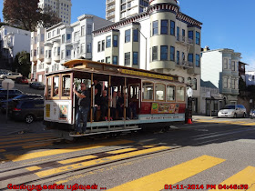
Cable Car

San Francisco Cable Car Museum

The Cable Car Museum is a free museum in the Nob Hill neighborhood of San Francisco, California. Located at 1201 Mason Street, it contains historical and explanatory exhibits on the San Francisco cable car system, which can itself be regarded as a working museum.
San Francisco Cable Car Museum
Cable Car Hyde Street SFO
The museum contains several examples of old cable cars, together with smaller exhibits and a shop. The cable cars displayed include
Ø  Sutter Street Railway - grip car 46 and trailer 54 dating from the 1870s
Ø  Clay Street Hill Railroad - grip car 8, the only surviving car from the first cable car company.
Exterior of the Ferries and Cliff House Railway Co. Building Constructed in 1887. Houses both the cable car winding station, engines, and museum. The smoke stack in the rear was damaged in the 1906 San Francisco earthquake, restored then soon decommissioned when steam power was replaced with electrical power at the winding station.
Cable Car Grip
Cable Car SFO
Cable Car Transfers
San Francisco Cable Car Parts
The museum is part of the complex that also houses the cable car power house, which drives the cables, and the car depot (barn). The car depot is not accessible, but two overlook galleries allow the visitor to view the power house, and to descend below the junction of Washington and Mason streets in order to view the large cavern where the haulage cables are routed via large sheaves out to the street.

It displays various mechanical devices such as grips, track, cable, brake mechanisms, tools, detailed models, and a large collection of historic photographs.

The museum was established in 1974, and is run by the Friends of the Cable Car Museum. It is entered from an entrance at Washington and Mason.
Cable Car Market Street SFO
SFO Cable Car Ride
Cable Car Powell
SFO Cable Car Museum
Located in the historic Washington/Mason cable car barn and powerhouse, the museum deck overlooks the huge engines and winding wheels that pull the cables. Downstairs is a viewing area of the large sheaves and cable line entering the building through the channel under the street.

Apr 20, 2016

SFO Civic Center

San Francisco Civic Center

The Civic Center in San Francisco, California, is an area of a few blocks north of the intersection of Market Street and Van Ness Avenue that contains many of the city's largest government and cultural institutions. 
Civic Center in San Francisco California
SFO Civic Center
It has two large plazas (Civic Center Plaza and United Nations Plaza) and a number of buildings in classical architectural style. The Bill Graham Civic Auditorium (formerly the Exposition Auditorium), the United Nations Charter was signed in the War Memorial Veterans Building's Herbst Theatre in 1945, leading to the creation of the United Nations. It is also where the 1951 Treaty of San Francisco (the peace treaty that officially ended the Pacific War with the Empire of Japan, which had surrendered in 1945) was signed. 

The San Francisco Civic Center was designated a National Historic Landmark in 1987, and listed in the National Register of Historic Places on October 10, 1978.
Civic Center California
USA National Historic Landmark Civic Centre
Civic Center Plaza and United Nations Plaza
Civic Center Plaza
SFO Civic Center Plaza
San Francisco’s Civic Center is located in the heart of the city, and contains many of San Francisco’s largest government and cultural organizations. Many of the buildings are built in the classical architecture style, giving the plaza a regal look and feel. Civic Center Plaza contains a vast amount of the city’s history, designating it a National Historic Landmark. The large, open plaza is a peaceful center for busy commuters and workers during the week and is a cultural hub during the weekends.

Apr 17, 2016

Baker Beach

San Francisco Baker Beach

Baker Beach is part of the Golden Gate National Recreation Area, San Francisco and is located between the Sea Cliff neighbourhood and the Golden Gate Bridge.
San Francisco Baker Beach
Golden Gate National Recreation Area
SFO Baker Beach, a mile (1.6 kilometres) of prime San Francisco coastline in the southwest corner of the Presidio, attracts a diverse crowd. Nestled in the shadow of the Golden Gate Bridge, this sandy promenade offers exquisite views of the Pacific Ocean. Baker Beach has beautiful views of the Golden Gate Bridge and is easily accessible from anywhere in San Francisco.

It is a public beach on the peninsula of San Francisco, California, U.S.. The beach lies on the shore of the Pacific Ocean to the northwest of the city. It begins in south of Golden Gate Point (where the Golden Gate Bridge connects with the peninsula), extending southward toward the Sea cliff peninsula, the Palace of the Legion of Honor and the Sutro Baths. The northern section of Baker Beach is  frequented by clothing-optional sunbathers. 
SFO Baker Beach
Sea Cliff Golden Gate Bridge
Baker Beach SFO
Nude Beach in SFO
Golden Gate Bridge View from Baker Beach

SFO Battery Chamberlin


Battery Chamberlin is an artillery battery in the Presidio of San Francisco, San Francisco, California, United States. The battery is named in honor of Captain Lowell A. Chamberlin, who had served with distinction in the Civil War. It was added to the National Register of Historic Places on November 7, 1976. Battery Chamberlin is located at the north end of the Baker Beach parking lot.
Harbor Defense of San Francisco
Two Centuries of Defending the Gate
SFO Battery Chamberlain


Apr 14, 2016

Lone Cypress

Lone Cypress in 17-Mile Scenic Drive 

Lone Cypress is one of the famous natural attraction in 17-Mile Drive. The official symbol of the city of Pebble Beach, it has endured on its cliff-top perch for over 250 years. 
Lone Cypress California
Lone Cypress in 17-Mile Scenic Drive
It has now come to symbolize fortitude and strength through its many years of perseverance in the face of wind, storms, and indeed the centuries themselves.

Standing on a granite hillside off California's scenic 17-mile drive in Pebble Beach, the Lone Cypress is a western icon, and has been called one of the most photographed trees in North America. The tree is located between Cypress Point Golf Course and the Pebble Beach Golf Links, two of world's most well known golf courses. Tree can be clearly seen from Cypress Point Lookout.

Check this below link for 17-Mile Drive and stops over's in 17-Mile Drive.
Monterey Cypress Tree
Pebble Beach Symbol
17-Mile Drive Attraction Points
Lone Cypress Point Lookout
California scenic 17-mile drive
Cypress Point Golf Course


Apr 11, 2016

17 Mile Drive

17 Mile Scenic Drive in Pacific Grove

17-Mile Drive is a scenic road through Pebble Beach and Pacific Grove on the Monterey Peninsula in California, much of which hugs the Pacific coastline and passes famous golf courses, mansions and scenic attractions, including the Lone Cypress, Bird Rock and the 5,300-acre Del Monte Forest of Monterey Cypress trees.
California 17 Mile Scenic Drive
Poppy Hills Golf Course 17 Mile Drive
Pebble Beach in 17 Mile Drive
The drive serves as the main road through the gated community of Pebble Beach. Inside this community, non-residents have to pay a toll to use the road. Like the community, the majority of 17-Mile Drive is owned and operated by the Pebble Beach Corporation. 
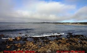
Point Joe in 17 Mile Drive
Pebble Beach Pacific Grove
The Restless Sea in 17 mile drive
Once entering and paying the toll, every visitor receives a small map of 17-Mile Drive, and it provides all the information you need, including the names of the stops along the way. There are 21 stop on the way through 17-Mile Drive, they are
ü  Shepherd’s Knoll
ü  Huckleberry Hill
ü  Poppy Hills Golf Course
ü  The Inn & Links at Spanish Bay
ü  Spanish Bay
ü  The Restless Sea
ü  Point Joe
ü  China Rock
ü  Bird Rock Hunt Course
ü  Bird Rock
ü  Seal Rock Picnic Area
ü  Spyglass Hill Golf Course
ü  Fanshell Overlook
ü  Crocker Grove
ü  The Lone Cypress
ü  The Ghost Tree
ü  Pescadero Point
ü  The Lodge at Pebble Beach
ü  Peter Hay Par-3 Golf Course and 100th Open 2000 Pebble Beach Monument
ü  Pebble Beach Equestrian Center

Cypress Point lookout 17 Mile Scenic Drive
Seal Rock Picnic Area 17 Mile Drive
17 Mile Scenic Drive in Pacific Grove
How to Reach : The 17-Mile Drive (27 km) scenic loop having four primary entrances - the main highway entrance at California State Route 1, and entrances in Carmel and Pacific Grove.